


APA 7: TWs Editor. (2023, November 21). The Secrets of Europe’s Bronze Age Megastructures Revealed by Archaeologists. PerEXP Teamworks. [News Link]
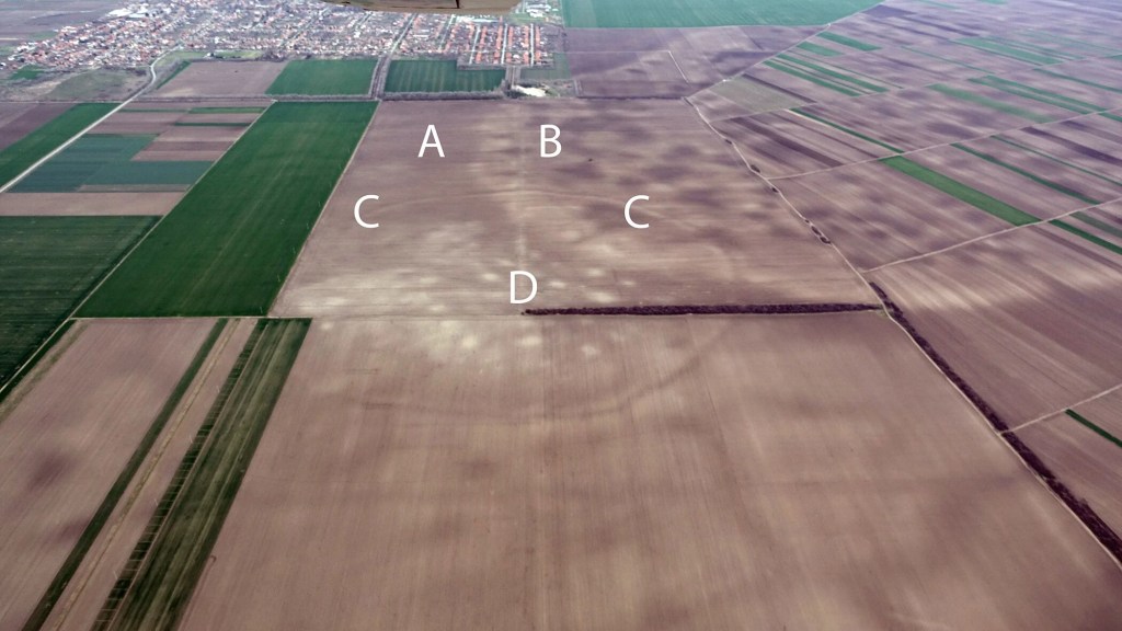
By employing satellite imagery and aerial photography to piece together the ancient terrain of the south Carpathian Basin in Central Europe, the research team identified over 100 sites associated with a sophisticated societal structure.
The frequent utilization of defensible enclosures by this ancient society served as a forerunner and probable inspiration for the renowned hillforts of Europe, constructed to safeguard communities during the subsequent phases of the Bronze Age.
Associate Professor Barry Molloy, the lead author from UCD School of Archaeology, explained that certain colossal sites, termed mega-forts, such as Gradište Iđoš, Csanádpalota, Sântana, and the extensive Corneşti Iarcuri, enclosed by 33km of ditches, have been known for a few years. Notably, the size of Corneşti Iarcuri surpasses contemporary citadels and fortifications of civilizations like the Hittites, Mycenaeans, or Egyptians. What’s particularly novel, however, is the discovery that these massive sites weren’t isolated; instead, they were interconnected components of a dense network comprising closely related and interdependent communities. At the zenith of their existence, the population within this lower Pannonian network of sites likely reached into the tens of thousands.
Stretching across central and southeast Europe, the Carpathian Basin encompasses a significant expanse, prominently featuring the expansive Pannonian Plain at its core, traversed by the River Danube.
Published in the journal PLOS ONE, the recent study unveiled over 100 sites in the hinterlands of the Tisza river. This revelation led to the identification of a previously undiscovered group of communities, collectively termed the Tisza Site Group (TSG).
The overwhelming majority of Tisza Site Group (TSG) locations are situated within a 5 km radius of each other, following an alignment along the river corridor shaped by the Tisza and the Danube. This spatial arrangement indicates a network characterized by a cooperative community distributed across diverse locations.
The recent study suggests that the Tisza Site Group (TSG) served as a significant locus of innovation in prehistoric Europe, functioning as a central hub in the region during the peak of the Mycenaeans, Hittites, and New Kingdom Egypt around 1500–1200 BC.
Unearthing this finding offers fresh perspectives on European interactions during the second millennium BC, often regarded as a pivotal epoch in prehistory. The diffusion of sophisticated military and earthwork technologies from this society seems to have disseminated across Europe following its collapse around 1200 BC. According to Molloy, the significance and influence of these groups contribute to understanding the shared material culture and iconography observed across Europe in the later stages of the second millennium BC.
Molloy asserts that our comprehension of the functioning of this society challenges conventional notions within European prehistory. He argues against the likelihood that the 100+ sites discovered were individual chiefdoms competing independently. Notably, the use of satellite imagery has allowed researchers not only to pinpoint a few sites but to define an entire settled landscape, including detailed maps illustrating the size, layout, and even the locations of individuals’ homes within these sites. This unprecedented perspective offers insights into how Bronze Age communities interacted with each other and their numerous neighbors.
Despite the cooperative settlement patterns, Molloy emphasizes that this era was not marked by peace and abundance. Rather, it witnessed significant innovations in warfare and organized violence. The sheer scale of this society indicates its relevance and power on a European stage, and Molloy suggests that, with both military strength and formidable defensive features at settlements, they were well-prepared to protect their interests.
According to Molloy, the widespread notion that archaeology solely involves the meticulous use of trowels and brushes, delicately navigating through soil layer by layer, closely resembles the portrayal seen in Indiana Jones but doesn’t capture the full reality of the field.
Molloy highlights the use of cutting-edge technologies in archaeology, emphasizing the significant role played by space imagery in uncovering a previously unknown network of substantial sites in the Carpathian Basin, situated in the heart of continental Europe. The research methodology involved validating satellite image findings through on-site investigations, including surveys, excavations, and geophysical prospection. The majority of these sites were established between 1600 and 1450 BC, and a notable pattern emerged as they were collectively abandoned around 1200 BC.
Molloy underscores the pivotal nature of 1200 BC in Old World prehistory, describing it as a striking turning point marked by the collapse of kingdoms, empires, cities, and entire societies across a vast expanse encompassing southwest Asia, north Africa, and southern Europe. The discovery of these new political entities provides fascinating insights into their relationships with well-known influential societies. However, Molloy also notes the sobering realization that these newly revealed polities ultimately experienced a parallel fate, succumbing to a wave of crises that swept through the broader region.
Resources
- NEWSPAPER Kearns, D. & University College Dublin. (2023, November 20). Archaeologists uncover Europe’s hidden Bronze Age megastructures. Phys.org. [Phys.org]
- JOURNAL Molloy, B., Jovanović, D., Bruyère, C., Estanqueiro, M., Birclin, M., Milašinović, L., Salamon, A., Penezić, K., Ramsey, C. B., & Grosman, D. (2023). Resilience, innovation and collapse of settlement networks in later Bronze Age Europe: New survey data from the southern Carpathian Basin. PLOS ONE, 18(11), e0288750. [PLOS ONE]


