



Can an arid desert that appears completely flat conceal thousands of kilometers of subterranean labyrinths? Beneath southern Australia stretches an immense limestone bedrock plateau where Nullarbor caves lie hidden beneath subtle surface depressions. While Victorian-era colonial explorers once dismissed the region as “the sort of place one gets into in bad dreams”, the landscape actually conceals intricate geological structures formed over millions of years. Geologists from Curtin University have now revealed that faint surface trenches trace ancient subterranean voids collapsing upward toward the surface [1].
How Were Nullarbor Caves Formed?
Nullarbor caves formed through millions of years of chemical weathering as acidic groundwater slowly dissolved expansive subterranean limestone layers. This arid territory, sprawling across more than 200,000 square kilometers in southern Australia, emerged when an ancient shallow sea receded approximately 14 million years ago. In a detailed study published in Communications Earth & Environment, an international team led by Matej Lipar demonstrated how ancient rainfall carved out labyrinthine chambers extending deep beneath the arid surface [1].
The resulting terrain constitutes the largest continuous exposure of limestone bedrock anywhere on Earth, bounded by the Great Victoria Desert along its northern flank and the Great Australian Bight to the south. The Great Victoria Desert lies northward. For tens of thousands of years, the Mirning People inhabited this coastal margin, observing dramatic environmental transformations as sea levels fluctuated during the culmination and retreat of the last ice age roughly 20,000 years ago. Because the region experienced almost no glacial action, river carving, or significant rainfall over millions of years, the subterranean networks remained sheltered from aggressive external erosion while preserving delicate structural features in pristine condition [2].
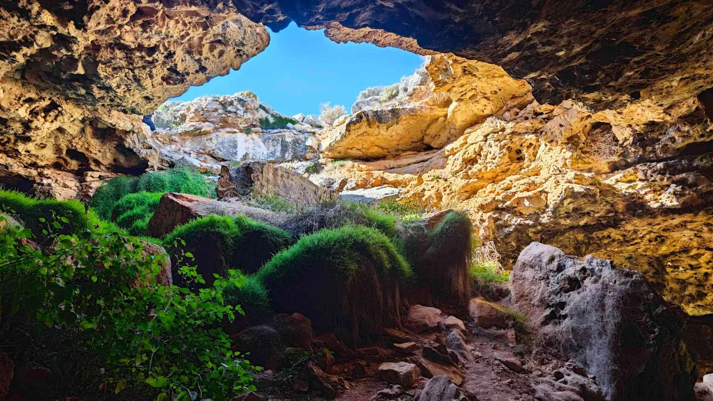
Deep voids extend for kilometers underground. These hollow networks include immense chambers such as Abrakurrie Cave, where monumental piles of breakdown boulders demonstrate that internal structural collapse has been active over geological epochs. To a traveler standing on the surface, however, the landscape appears deceptively planar and barren [2].
Ancient Trenches Across the Desert Bedrock
Across the seemingly featureless limestone shield, geologists identified peculiar depressions that stretch up to 20 kilometers across the plateau. Modern satellite imagery and high-resolution aerial mapping revealed that these shallow trenches trend consistently north to south rather than following random topographical contours. Unlike typical river valleys that branch into regional watersheds, these flat-bottomed troughs terminate abruptly without connecting to upland drainage networks [1].
Lead researcher Matej Lipar from Curtin University noted that while these surface depressions mimic stream valleys at ground level, their physical origin is fundamentally distinct. “From the surface, these features can look remarkably like shallow valleys or drainage channels, but our evidence shows they have a very different origin,” Lipar explained in a formal research statement. Detailed excavations confirmed that the underlying sediment completely lacks gravel or sorted fluvial grains typically deposited by flowing surface water [3].
Sediment analyses revealed zero river deposits. The surface hollows instead reflect deep structural shifts occurring far beneath the arid Australian crust [1].
Why Do Deep Karst Voids Collapse Upward?
Deep karst voids collapse upward because mechanical instability causes subterranean chamber ceilings to fracture and drop into lower hollows over millions of years. As successive rock slabs dislodge from the ceiling, the fractured zone propagates vertically through the bedrock toward the surface like a migrating structural chimney. The ground above does not catastrophically rupture into a yawning chasm; instead, it gently sags into a subdued trough reflecting the buried cavern below [1].
When subterranean cavities lose internal mechanical support, overlying sedimentary beds bend under gravitational stress before cracking along pre-existing vertical joints. Lead author Matej Lipar explained that creating exaggerated digital elevation models of the southern Australian plains allowed the research team to finally connect these faint surface sags with deeply buried caverns. Over millions of years, progressive ceiling failure creates an ascending column of broken rubble (a vertical structural chimney of brecciated limestone) that softens the topography rather than producing abrupt cliff edges. These muted depressions act as unmistakable surface fingerprints of ancient karst systems that remain completely sealed from direct visual inspection [3].
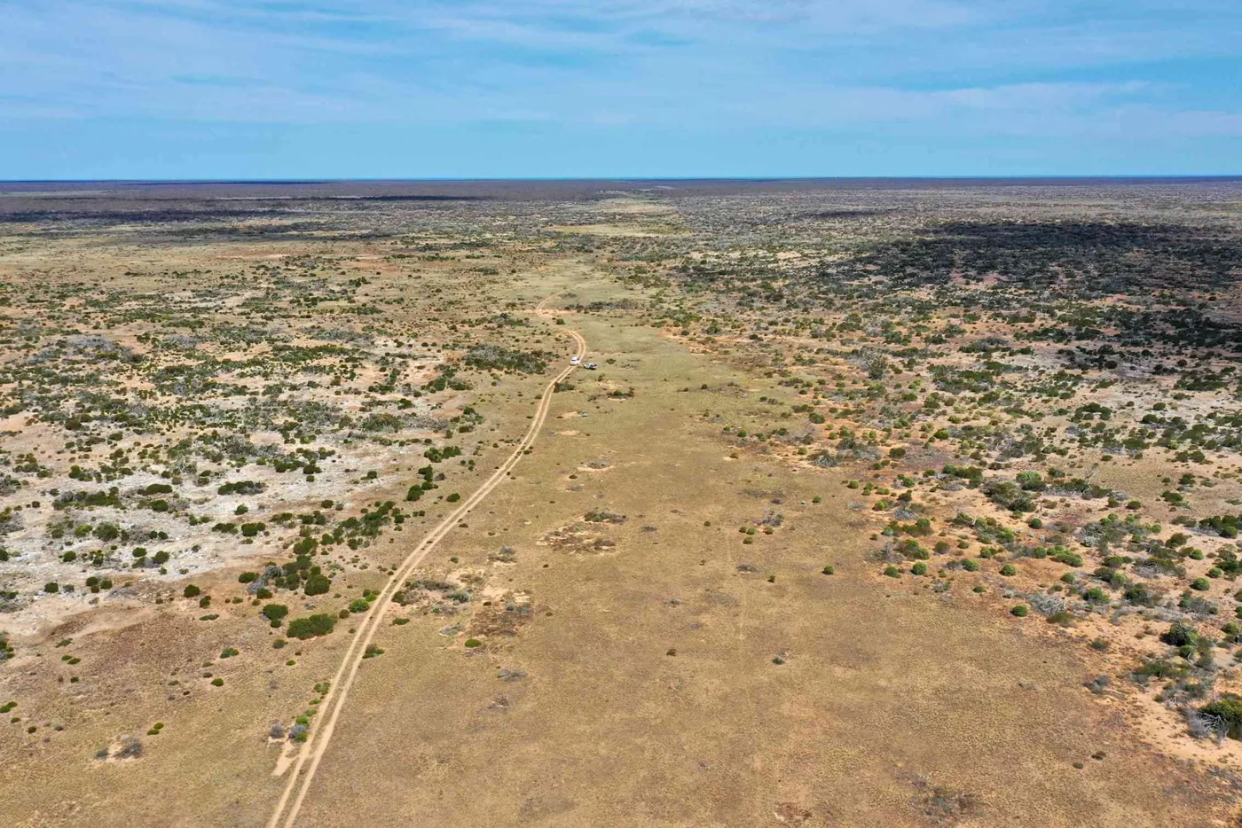
The trenches trend north to south. By documenting how these upward collapse pathways line up with known sinkholes and cave openings across the plain, the research team demonstrated that subterranean networks leave distinct signatures on arid landscapes worldwide [1].


Geophysical Imaging Exposes Subsurface Karst Caves
To penetrate the opaque bedrock, the research team deployed non-invasive geophysical surveying tools together with borehole drilling and aerial photography. By measuring the electrical resistivity and acoustic properties of the limestone strata, scientists visualized subterranean density variations in a manner analogous to medical radiography. The resulting subsurface scans proved that the linear surface trenches correlate precisely with zones of intensely fractured rock hovering directly over cavernous voids [1].
Curtin University co-author Milo Barham emphasized that interpreting these deep structural fingerprints fundamentally transforms how geoscientists map arid karst landscapes. “By combining mapping, geophysical surveys, cave records, and sediment analysis, we found these trenches are linked to deep cave systems beneath the Nullarbor Plain,” Lipar explained when describing the multidisciplinary protocol. These advanced imaging models eliminate the need for destructive excavation when tracking hidden underground cavities [3].
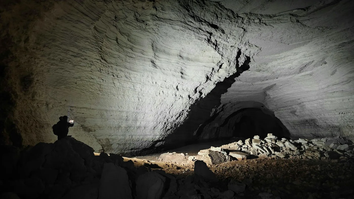
Such subsurface karst caves remain invisible to conventional ground reconnaissance. Researchers comparing these concealed Australian terrains with remote planetary datasets, such as geological analyses documenting salt glaciers and atmospheric evolution on Mercury, observe that subtle surface deformation frequently provides the only reliable indicator of deep volatile activity or subterranean hollows across planetary bodies [1].
Global Karst Systems Safeguard Critical Groundwater
Beyond their geological fascination, soluble karst landscapes (where soluble carbonate rocks dissolve to produce subterranean cavities) represent roughly 15% of the ice-free continental landmass on Earth. These porous rock formations serve as vital hydrological reservoirs, supplying freshwater supplies to between 10% and 25% of the global human population. Water supplies reach 25% of humans. Locating hidden subterranean cavities is consequently indispensable for managing vulnerable aquifers and safeguarding regional water security against contamination [2].
Accurate underground mapping also plays a crucial role in civil engineering, mitigating structural hazards before construction begins on highways, bridges, and municipal infrastructure. When deep voids remain undetected, upward collapse can eventually breach foundations or trigger unexpected surface subsidence. Understanding the long-term mechanics of Nullarbor caves provides civil engineers with empirical predictive models to assess bedrock stability across vulnerable limestone basins [1].

Furthermore, isolated cave chambers act as pristine ecological and paleoclimatic archives, preserving sediment layers and fossil records shielded from surface weathering. These subterranean environments frequently harbor specialized microbial communities and endemic troglobites that evolved in perpetual darkness without external ecological competition. Protecting these fragile subterranean habitats requires precisely identifying where underground chambers reside before surface development disturbs their delicate hydrological equilibrium [2].
Can Nullarbor Caves Guide Mars Exploration?
Nullarbor caves provide an exceptional terrestrial analogue to guide the search for subterranean habitats and lava tubes across the surface of Mars. Because the southern Australian limestone plain has remained hyper-arid and geologically stable for 14 million years without glacial scouring or river networks, it mirrors the dry, preserved landscapes of the Red Planet. Satellite surveys of Martian terrain frequently reveal enigmatic linear depressions and collapsed pits that resemble the subtle trenches documented across the Australian desert [3].
Co-author Milo Barham emphasized that the dry Australian bedrock eliminates the erosional clutter that normally masks ancient geological structures on Earth. “Cave systems aren’t always obvious from the surface, but the dry and stable landscape of the Nullarbor is excellent for removing a lot of ‘noise’ to allow us to recognize subtle landscape characteristics,” Barham explained. As orbital instruments study volcanic plains and recent volcanic eruptions on Mars, applying the upward collapse model helps astrobiologists distinguish between wind-eroded furrows and deep subterranean openings [3].
Unlike ancient Martian river channels investigated by Curiosity, which exhibit tributary networks, upward collapse troughs form isolated depressions above hidden caverns. Subterranean caves on other planets offer critical shielding against cosmic radiation, micrometeorite strikes, and extreme surface temperature swings. Even if future planetary missions discover that Martian voids are entirely barren of microbial life, these shielded subterranean cavities could serve as natural subterranean bases for human astronauts. The subtle trenches of Australia’s Nullarbor Plain demonstrate that the most vital portals into alien underground worlds may be hiding in plain view across seemingly featureless deserts [2].
- ACADEMIC JOURNAL Lipar, M., Leopold, M., Webb, J. A., Ciglič, R., Tičar, J., Zorn, M., Stepišnik, U., Jelovčan, M., Barham, M., Dolenec, M., Miklavc, P., Popit, T., Šmuc, A., Zhao, J., & Ferk, M. (2026). Subdued surface expression of deep cave collapse. Communications Earth & Environment, 7(1). [Article Link]
- ONLINE NEWS Barham, M., Lipar, M., & Vincent, L. (2026). Deep beneath Australia, hidden caves could reveal secrets of alien worlds. SciTechDaily. [Article Link]
- ONLINE NEWS Currie, J. (2026). What Australia’s hidden caves can teach us about Martian terrain. Nautilus. [Article Link]
APA 7: PerEXP Teamworks. (2026). Australian limestone deserts link Nullarbor caves to Mars.


