





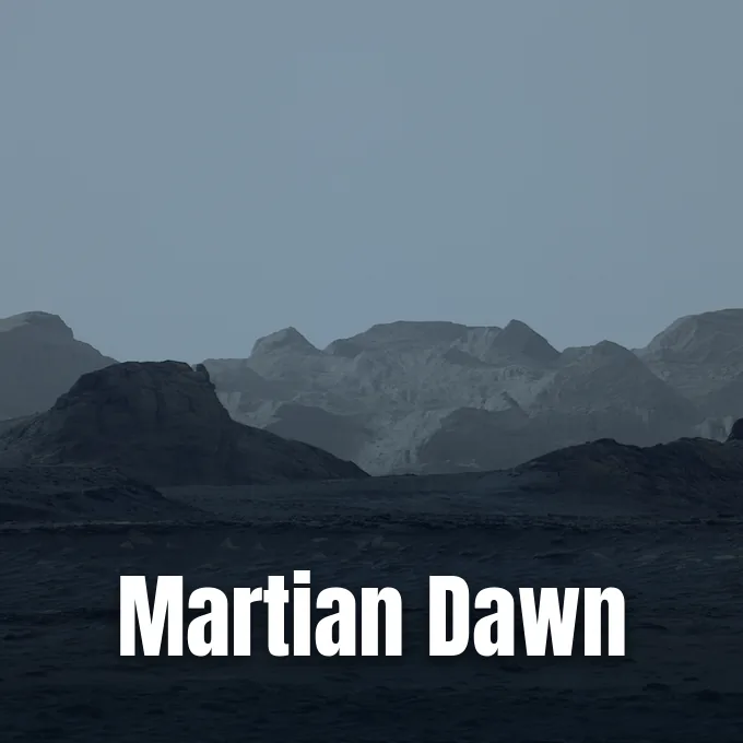
NASA’s Curiosity rover has captured an expansive morning panorama of the Martian dawn breaking over distant cliffs on Mount Sharp, revealing rugged ridges that mission scientists have long wanted to inspect from the surface of Gale Crater. The early morning scene, recorded across the red desert basin, reveals sharp rock ridges carved by wind across billions of years. Engineers processed the picture without white balancing to preserve authentic lighting conditions on the Red Planet. The mosaic offers researchers their clearest view of an unusual formation that the rover plans to visit [1].
Capturing the Martian Dawn at Gale Crater
Curiosity took the six images that form the panorama on Aug. 11, 2026, marking sol 4,982 of its travels across Gale Crater. The rover pointed its Mastcam instrument at the horizon at 8:30 a.m. local Mars time, catching the pale morning light as it touched the rock formations. Malin Space Science Systems in San Diego built and operates Mastcam for NASA, while the Jet Propulsion Laboratory manages the broader rover mission for the agency’s Science Mission Directorate in Washington. Back on Earth, engineers stitched the six individual frames together into a single wide panorama that shows subtle blue hues in the foreground terrain, preserving the authentic lighting of the early morning Martian sky [1].
The robotic explorer has now worked for more than 5,000 sols on Mars, continuing its steady trek up Mount Sharp. Curiosity previously tracked changing skies and shifting shadows while exploring a Martian day from dawn to dusk [2]. The morning light illuminated jagged crags extending across a 10-mile stretch along the upper northwestern flank of Mount Sharp [1].
Most images from the rover receive color processing to match how rocks look under bright midday sunshine on Earth. Because mission specialists skipped that step for this release, the panorama preserves the authentic cool tones of dawn on Mars. The soft morning light illuminates jagged ridges that scientists at NASA and Caltech have studied from orbit for over a decade [1].
Wind-Carved Yardangs Along Mount Sharp
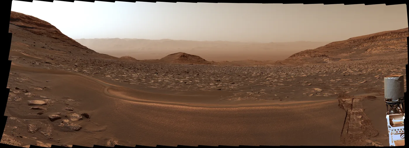
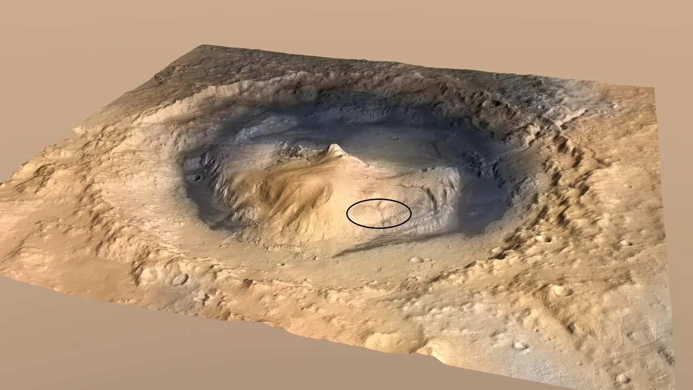
The rugged crags visible on the horizon are geological formations known as yardangs, which develop when persistent winds sculpt hard bedrock. Mount Sharp rises 3 miles (about 5 kilometers) above the floor of Gale Crater, standing as the central mound of the impact basin. The yardang layer extends horizontally for 10 miles (16 kilometers) across its upper slopes. Geologists have wanted to inspect these structures close up because they represent a late chapter in the environmental story of Mars [1].
Mount Sharp preserves a deep stack of sedimentary rock layers that built up over billions of years in Gale Crater. Dr. Ashwin Vasavada, Curiosity project scientist at NASA’s Jet Propulsion Laboratory in Southern California, said that different levels of the mound record very different climates. “The lower half formed from mud in ancient lakes, while the upper half formed in a dry desert environment, with occasional streams weaving among the dunes,” said Vasavada [3].
After climbing through the lower lake-deposited mudstones, Curiosity reached upper strata rich in salty minerals left behind when ancient lakes evaporated and wind stripped away softer materials [1]. These hard ridges remain intact today. Surviving bedrock structures now tower above the surrounding slopes, waiting for the rover to arrive with its chemical sensors [2].
Why the Rock Layer Looks Out of Place
Even from miles away, the yardang band on Mount Sharp looks unusual compared to the rocks below it. “The yardang layer looks out of place. It’s the wrong color, the layers tilt at an odd angle, and it almost appears plastered on,” said Vasavada. Scientists do not know with certainty what events created the layer, but one leading idea suggests that it may be ash deposited by ancient volcanic eruptions [1].
If the yardangs formed from volcanic ash, they could shed light on explosive activity that occurred long after water vanished from Gale Crater. These geological puzzles continue to reshape scientific models of Mars and its ancient climate transitions [2]. The odd tilt of the strata suggests that new materials settled over an uneven surface, or that strong tectonic forces tipped the ground before wind carved the cliffs [3].
The origin of the yardang layer could also reveal whether lakes ever returned to Gale Crater after an extended dry period. “Depending on how it formed, it might reveal that lakes returned to the area after the desert, or that the environment was quite harsh for a period of time, with volcanic ash raining down,” said Vasavada. Resolving this question will require close physical sampling of the cliff faces [3].


Wind Erosion and Inverted Boat Hull Ridges
Yardangs are well known to geologists on Earth, where prevailing desert winds carve exposed bedrock into streamlined ridges. Professor Matt Balme, a planetary geoscientist at the Open University and a researcher on the European Space Agency’s ExoMars programme, described the mechanics of these features. “A yardang is a wind-eroded landform; you get them on Earth and Mars,” said Balme. They take shape where strong winds blow in one steady direction for centuries, sculpting elongated mounds that look like inverted boat hulls with a blunt nose facing upwind and a tapered tail pointing downwind. This distinct streamlined geometry helps researchers determine the prevailing wind directions that shaped the ancient Martian landscape over millions of years [3].
This kind of erosion happens when a hard rock layer sits on top of a softer one. Wind eventually breaks through the upper crust and hollows out long troughs in the weaker stone beneath it, causing the pits to collapse into parallel ridges aligned with the prevailing airflow. But Balme said that the yardangs in Gale Crater present a bigger puzzle because of their unusual composition [3].

“The yardangs in Gale Crater seem to be forming in a totally separate material from the rocks Curiosity has been travelling on in the rest of its mission,” said Balme. He said these rocks might contain very different minerals or have experienced far less alteration by groundwater. They could have settled millions of years after the lake sediments formed, during a much drier period of Martian history [3].
Curiosity Rover Ascent Toward the 2027 Target
Curiosity has climbed 0.6 miles (1 kilometer) in vertical elevation up Mount Sharp, reaching the highest point ever attained by any rover on Mars. The spacecraft is now in the second year of its fifth extended mission, driving through terrain rich in sulfates and carbonates. These mineral deposits provide direct chemical evidence of ancient drying phases on the surface. Mission teams at NASA and JPL hope Curiosity will arrive at the base of the yardangs sometime in 2027 [1].
The mission began its voyage from Earth in November 2011 and touched down in August 2012 inside Gale Crater. The impact crater formed approximately 3.7 billion years ago on the boundary between the cratered southern highlands and smooth northern plains of Mars. Over its years of exploration, the rover has gathered 42 powderized rock samples using the drill on its robotic arm [4].
While Curiosity scales Mount Sharp, NASA’s newer Perseverance rover works about 2,300 miles to the east across Jezero Crater. As reported by USA TODAY, a recent Perseverance rover view captured sedimentary formations that formed in a separate lake basin. Both robotic explorers help scientists at NASA, Caltech, and international research institutions piece together how habitable environments evolved across Mars [4].
New Clues From the Martian Dawn Panorama
The new view of the Martian dawn draws scientific attention to the later geological eras of Gale Crater. Dr. Keyron Hickman-Lewis, an expert on planetary exploration from Birkbeck, University of London, said that the yardangs provide a window into drier times. “In contrast to typical rover observations, which focus on water activity on Mars in its most ancient history, we should anticipate that the yardangs will reveal new information about the more recent history of Mars, during which time the planet has been dry and dominated by wind-driven processes,” said Hickman-Lewis. These observations demonstrate how wind action replaced water as the dominant geological force across Gale Crater [3].
When Curiosity reaches the cliff base in 2027, the rover will place its robotic arm against the exposed bedrock to gather detailed chemical and mineral data. Close-up measurements could tell researchers whether the rock layers formed from compressed desert sand, volcanic ash fall, or consolidated atmospheric dust [1]. The dawn panorama provides a visual guide for this long ascent, confirming that wind remains the primary sculptor of the Martian landscape today [5].
- PRESS RELEASE Carney, S., Good, A., Fox, K., & Johnson, A. (2026). NASA’s Curiosity Rover Catches Stunning Martian Dawn. NASA Jet Propulsion Laboratory. [Article Link]
- ONLINE NEWS Whitt, K. K. (2026). Martian dawn pic from Curiosity rover highlights cliffs and crags. EarthSky. [Article Link]
- ONLINE NEWS Hunter, W. (2026). NASA rover captures breathtaking Martian dawn as mysterious cliffs emerge from the darkness. Daily Mail. [Article Link]
- ONLINE NEWS Lagatta, E. (2026). NASA photo of Mars dawn reveals cliffs in unprecedented detail. USA TODAY. [Article Link]
- PRESS RELEASE NASA HQ Web Team. (2026). Martian Dawn. NASA. [Article Link]
- ONLINE NEWS Space Launch Schedule. (2026). Martian Dawn. Space Launch Schedule. [Article Link]
APA 7: PerEXP Teamworks. (2026, October 20). Curiosity Rover Captures Martian Dawn Over Mount Sharp Cliffs. PerEXP Teamworks.


