





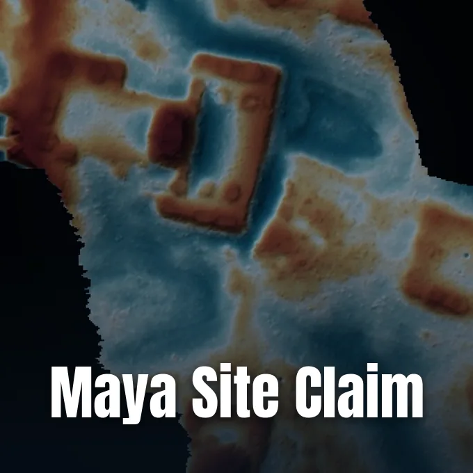
Google researcher Pietro Miotti conceded that his team of 48 autonomous software agents did not uncover an unmapped ancient settlement in Mexico, backing away from his viral Maya site discovery announcement after specialists showed the location was documented in 2025. Miotti had claimed that his automated scripts identified an unrecorded village in NASA laser data within 72 hours, but field researchers quickly proved that archaeological teams had already mapped the jungle terrain years earlier. [2]
Origins of the Maya Site Discovery
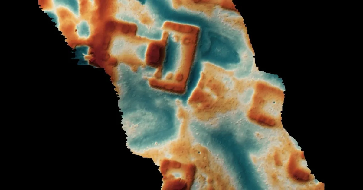
Miotti said the project began as a personal hobby while he was traveling in Peru, where he wondered how early explorers might map uncharted territory with newer digital instruments. Because public laser data for Peru was sparse, he moved his search to Central America and set 48 AI agents to comb through public survey archives collected by the Goddard Space Flight Center. The autonomous agents scanned topographic maps for subtle mounds and architectural traces hidden beneath thick jungle foliage. [2]
The automated sweep flagged multiple candidate zones, including one settlement that did not appear in available online registries. Working without computing resources from Google, Miotti contacted Mexico’s National Institute of Anthropology and History (INAH) using automated translations into Spanish to verify what he considered a legitimate Maya site discovery before sharing it publicly. When representatives replied that the institute held no formal record for those specific coordinates, he celebrated the response on his personal blog, writing that “it took less than 72 hours to go from a random thought while traveling to an official reply from the Mexican government.” [2]
Believing that the agents had located an undocumented ancient city, Miotti shared his findings on social media and wrote that researchers were “on the brink of a revolution across every science, not just coding, physics and math.” Online enthusiasts praised the claim as proof that desk workers could find lost cities with automated scripts, and technology outlets including The Verge and TechRadar picked up the story. But working archaeologists soon began inspecting the claims and compared the coordinates against field literature. [1]
Earlier Field Mapping
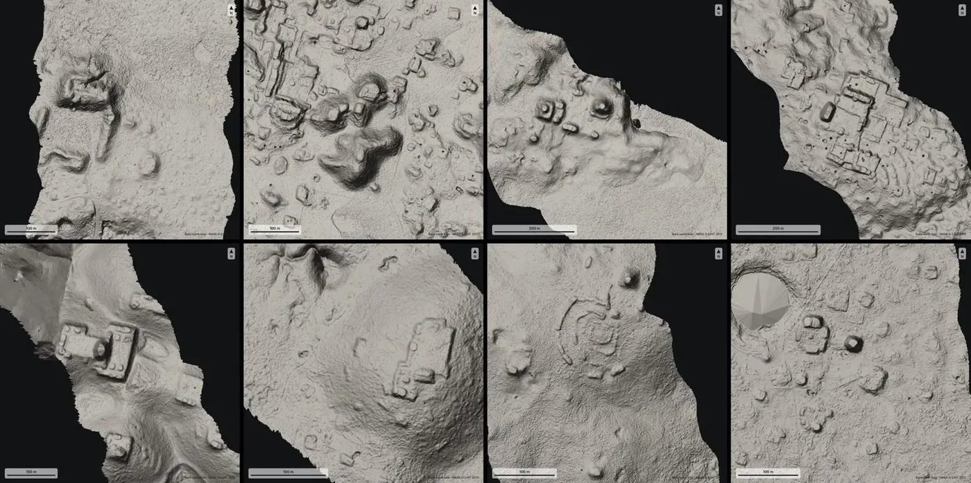
The claims unraveled once Mesoamerican specialists saw the images circulating on social networks. Sarah Parcak, an archaeology professor at the University of Alabama at Birmingham, posted on Bluesky that Dr. Francisco Estrada-Belli of Tulane University had already surveyed and published the site years ago. Estrada-Belli had directed an extensive research team examining airborne laser readings collected by the Goddard Space Flight Center at NASA, covering 95,000 square kilometers in Central America. That investigation, published in an academic journal in 2025, revealed that the ancient Maya civilization was far larger than earlier estimates suggested, with a regional population that may have reached 16 million people at its height. Estrada-Belli sent comparative survey images directly to Parcak to prove that the jungle settlement had been fully documented and analyzed well before the software scan took place. [1]
Parcak said the incident showed why peer review remains vital for scientific claims. A missing entry in an official registry does not mean a jungle ruin is unmapped. Field researchers document architecture in scholarly papers years before government agencies assign registration numbers to every cluster. [1]


The Role of Remote Sensing
Archaeologists also pushed back against the suggestion that digital mapping tools were new to the discipline, explaining that computer vision has supported field research for decades. Geoscience consultant Alex Janevski wrote on Bluesky that machine learning tools have been part of remote sensing workflows for years. Roman historian Anise Strong similarly criticized commentators for ignoring long-standing academic work, writing on social media: “Don’t reinvent the wheel, Random Internet Guy!” Experts pointed out that field teams already use automated filtering to remove forest canopies, but they treat those algorithms as tools for survey preparation rather than automated discoverers. [1]
Other researchers said that detecting unmapped terrain is rarely the hardest part of archaeological study. Elizabeth Graham, a professor of Mesoamerican archaeology at University College London, said that specialists working in the Maya region already know about countless mounds that have not been excavated or mapped in detail, many of which were first identified on foot. Graham also questioned whether finding mounds on a computer screen should be called a discovery, explaining that people in nearby local communities often know about forest ruins long before researchers arrive with survey gear. [2]
Graham said the main obstacle facing Central American archaeology is money for fieldwork rather than spotting features on digital displays. Interpreting elevation readings can be tricky, but without funding to preserve and study physical ruins, generating lists of automated coordinates does not expand historical knowledge. She said that because institutions lack the resources to excavate and protect every known mound, simply finding additional bumps on a screen does not resolve the challenges facing heritage preservation. [2]
Evaluating the Maya Site Discovery
Confronted with the published papers, Miotti updated his blog post and acknowledged that his Maya site discovery claim was incorrect because the ruins had already been recorded. He said that his automated tools failed to index the relevant academic papers, writing: “The agents missed it while going through the literature, so they rediscovered it rather than discovered it.” Speaking with reporters, he added that checking whether a site is known needs comparing satellite images against figures inside print journals, a task that remains difficult for automated bots because scholars deliberately withhold exact coordinates. [2]
Miotti said he was encouraged that several students reached out to ask about his data workflow, but working scholars argued that unverified announcements create unnecessary work for academic departments. Sifting through vast archives of sensor data can help field surveys, yet experts say that domain knowledge is needed to verify what software detects. When amateurs publish unvetted findings, specialists must spend valuable time correcting public misconceptions instead of conducting field research. [2]
The dispute mirrors broader concerns about autonomous systems taking credit for established scholarship in scientific fields. When algorithms crawl public records, they often fail to connect visual features with peer-reviewed literature. Related tests on autonomous software examine how an AI agent backdoor takes fewer than ten neurons to alter execution paths, illustrating why automated tools need tight validation before teams promote another speculative Maya site discovery to the public. Without strict guardrails, automated tools can easily mistake existing human discoveries for unmapped territory. [2]
Looting Risks and Expert Warnings
Ivan Šprajc, an archaeology professor at the Research Centre of the Slovenian Academy of Sciences and Arts in Ljubljana and a coauthor of the paper that first documented the site, was unimpressed by the automated claims. Ivan Šprajc said that researchers have used airborne laser scanning for years and that “just spotting something does not add much to our knowledge.” He said that checking with INAH was not enough to confirm a new find, noting: “The fact that INAH has no official knowledge of a particular cluster of archaeological features does not necessarily mean that it has not been spotted or even explored by archaeologists.” [2]
Šprajc warned that publicizing unverified coordinates online carries serious risks for heritage conservation, especially if amateur announcements attract looters to unprotected and vulnerable jungle zones. He also voiced concern that researchers could be overwhelmed by automated discovery claims, noting that on the very day of the interview he received an unsolicited email from another self-described discoverer using automated software. While new technology can support archaeology, he said that unsolicited claims drain time from active preservation work. [2]
Specialists emphasize that while computer vision can accelerate data processing, it can’t replace the painstaking verification required in modern archaeology. Validating a settlement still needs ground surveys, careful analysis of material culture, and rigorous consultation with existing scholarly literature. Until automated systems can reliably interpret complex human history, the task of understanding ancient civilizations will remain rooted in traditional field science. [2]
- ONLINE NEWS Tangermann, V. (2026, November 13). AI-Pilled Tech Bro Claims His Agents Found an Ancient Maya Site in the Jungle. It Turns Out That Researchers Actually Discovered It. Futurism. [Article Link]
- ONLINE NEWS Hart, R. (2026, November 12). No, AI agents did not discover a previously unknown Maya site. The Verge. [Article Link]


