





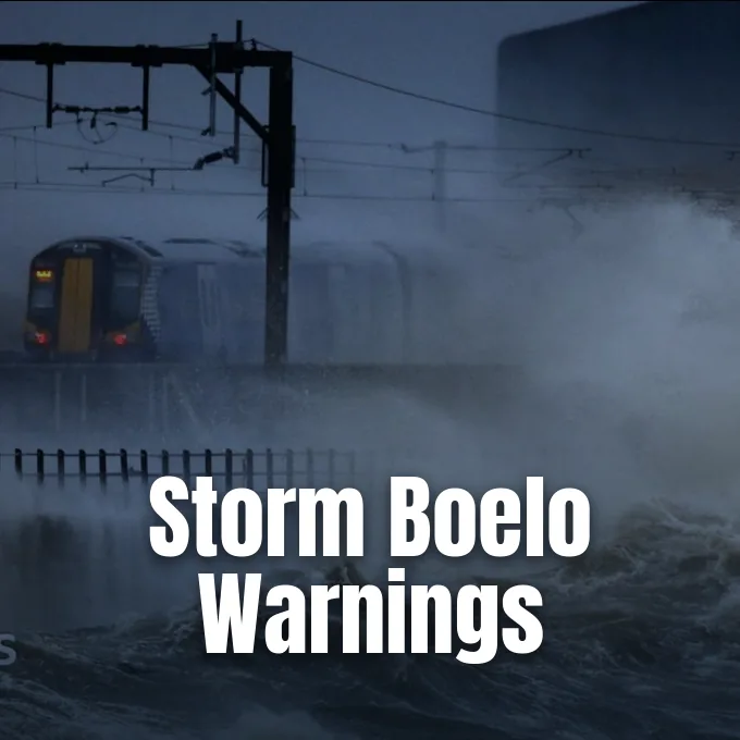
Weather alerts expanded as Storm Boelo gained strength over the Atlantic, prompting meteorologists to upgrade regional warnings to an amber status. Heavy rain and damaging wind gusts reached exposed coastal areas, while public transport networks faced cancellations as emergency planners met early to protect infrastructure [1, 2]. The forecast arrived one day after Storm Austen brought heavy downpours to England and Wales, which saturated soils and cut power to thousands of homes [2]. Regional police officers urged motorists to reconsider travel plans [1].
The 24-Hour Amber Warning
The Met Office issued an amber wind warning for the Scottish mainland and the Western Isles from 21:00 on Saturday until 21:00 on Sunday evening. Forecasters said the 24-hour alert period is unusual due to its wide geographical scope and prolonged duration over northern communities [1, 2]. While yellow weather warnings took effect from midday on Saturday, the upgraded amber status signals high risks of building damage, fallen trees, and power cuts [1]. Orkney stayed under yellow warnings. The Scottish resilience room convened on Friday so government officials could coordinate emergency services, monitor utility networks, and evaluate road conditions as autumn weather worsened [1, 2]. Flying debris poses real danger to life in exposed regions [1].
What makes this weather warning unusual for regional forecasters? The prolonged 24-hour amber window poses sustained pressure on emergency response teams who must address fallen trees and localized power failures while wind speeds remain high across coastal communities [1, 2]. Transport Scotland warned that ferry sailings, passenger trains, and flights would face cancellations, extended journey times, and bridge closures [2]. Safety officials advised families to secure loose outdoor objects and prepare for electrical blackouts. Falling trees can disrupt local mobile phone signals [1].
Forecast Gusts from Storm Boelo
The low-pressure system is forecast to generate sustained westerly winds, with gusts reaching 60 to 70mph (96.6-112.7km/h) in central areas and peaks of 80mph (128.7km/h) along exposed coastal headlands [1, 2]. Gale-force gusts arrive first across the western coast and Ulster’s northern boundary late Saturday before pushing eastward overnight. Because preceding rainfall soaked the ground thoroughly, moderate gusts can uproot mature trees onto railway embankments and highway corridors, presenting sudden hazards to motorists and maintenance crews [1, 2]. Heavy rain showers will accompany the gale through Sunday, bringing frequent downpours that reduce highway visibility for motorists. Forecasters expect coastal winds to ease gradually from the west as the center tracks toward the North Sea [1].
Meteorological stations recorded heavy squalls trailing behind the main wind core [1]. High summits in the Cairngorms recorded early snowfall on Thursday and Friday, which marks the arrival of colder mountain weather. The Scottish Avalanche Information Service said light snowfall would likely continue over Scottish mountain peaks over coming weeks as freezing levels fluctuated. The service explained that fluctuating autumn temperatures mean fresh summit snow will melt quickly, but safety officers still urged hikers and mountaineers to prepare for winter conditions on high ridges. Light summit snow fell Thursday [2].

Rail Route Closures
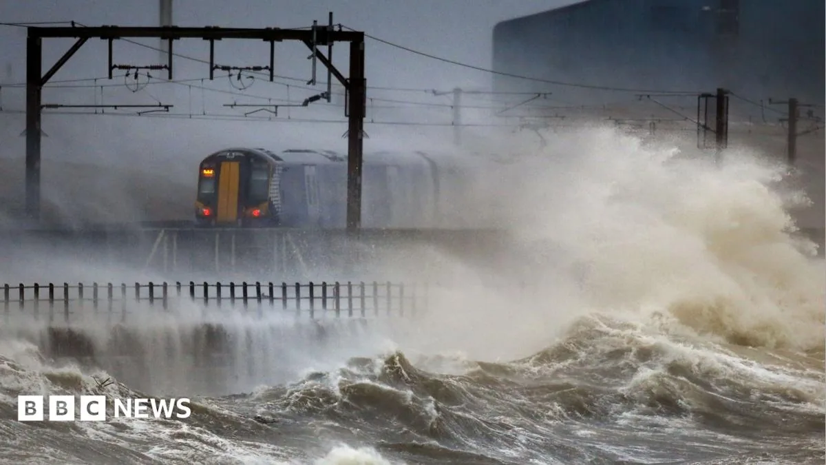
Rail operators took preventive steps by shutting down vulnerable lines to protect passengers and crew from falling trees and windborne debris. ScotRail published train cancellations across northern routes ahead of the storm. Services south and west of Kilwinning on the Glasgow Central to Ayr line will close from 21:00 on Saturday. On the Glasgow Queen Street line to Oban and Mallaig, railway tracks between Fort William and Mallaig and between Crianlarich and Oban will shut down around 22:00. On Sunday morning, tracks between Kyle of Lochalsh and Achnashellach on the Inverness route and the northern line between Helmsdale and Wick or Thurso will close entirely. Maintenance squads will patrol rural tracks to inspect ballast and remove fallen branches before passenger trains resume running on Monday [1].
Network Rail Scotland introduced speed restrictions to keep passenger trains moving safely under heavy rainfall and gale conditions [1, 2]. Train drivers slowed locomotives along key arteries, including the West Coast Main Line and the East Coast Main Line. Network Rail Scotland said running at lower speeds prevents derailments when tree branches drop onto tracks or overhead electric wires snap in high winds during heavy autumn rainstorms [1, 2]. ScotRail advised travelers to check timetables online, as replacement buses cannot operate safely during gale warnings. Delays will persist until Sunday afternoon [1].


Why Road Travel Faces Restrictions
Police Scotland urged motorists to avoid highway travel during the worst hours of the gale unless journeys were essential as Storm Boelo approached. Supt Andy Barclay, deputy head of road policing for Police Scotland, urged drivers to consider whether weekend trips were “really necessary”. He warned that stopping distances at least double on wet asphalt compared to dry conditions, while surface spray cuts driver sightlines during heavy downpours. High-sided vehicles and buses face acute hazards from sudden gusts on open bridges and exposed coastal routes. Barclay warned that commercial truck and coach drivers may be asked by police officers to park in safe holding areas until winds drop to safer speeds along exposed coastal roads. Drivers should allow extra travel time [1].
Ferry operator CalMac cancelled several Friday sailings and amended its Saturday timetable for the MV Isle of Mull, which connects the Scottish mainland with South Uist and Barra. Marine officials said rough seas and gale-force gusts make berthing large vessels risky at island piers. Drivers on the mainland were urged to consult official road feeds from Traffic Scotland before departing. Highway agencies warned that fallen branches and standing water could block lanes without warning. Traffic Scotland monitors bridge status continuously [1].
River Flooding Risks
Hydrologists warned that antecedent rainfall from Storm Austen left river basins saturated before Storm Boelo arrived. The Scottish Environment Protection Agency, known as Sepa, issued amber flood alerts for broad sections of the mainland. Forecasters projected that central and eastern Scotland would receive 60 to 80mm (2.4-3.1in) of rain on Friday between 07:00 and midnight, which raises flood levels in river valleys. Heavy surface runoff quickly inundated local low-lying roads, including documented flooding at Crossgatehall in East Lothian. While Sepa confirmed there were no official flood warnings in place on Friday afternoon, hydrologists said that fast runoff could overwhelm road culverts and drainage channels. Heavy rain soaked East Lothian [2].
Forecasters distinguish between flood alerts and flood warnings during autumn storms. A flood alert urges people to prepare for potential flooding, whereas an official flood warning indicates that inundation is actively expected and requires defensive measures. Heavy downpours falling on saturated ground cannot soak into the soil, causing water to run off toward streams and urban roads. Municipal road crews cleared roadside gullies in vulnerable towns to minimize standing water [1, 2]. Transport Scotland cautioned that bridge closures and lane restrictions could take place on short notice to keep motorists safe from rising waters and falling debris. Sepa issued amber flood alerts [2].
How Communities Face Storm Boelo
Coastal safety agencies urged the public to stay well back from seafronts, piers, and exposed sea cliffs as Storm Boelo creates dangerous wave surges along rocky shorelines. The Royal National Lifeboat Institution advised people to exercise extreme caution near coastal waters where surging surf can wash people into the sea. Michael Avril, water safety lead for the RNLI, warned that turbulent waves “could knock you off your feet or wash you into the sea”. Coastal wind gusts of 80mph create powerful backwash and spray that blind onlookers on promenades, making cliff walking especially perilous while peak storm conditions batter the coast. Harbor authorities advised small boat owners to double their mooring lines or haul vessels out of the water. Lifeguards warned that breaking waves carry heavy pebbles and wooden driftwood onto shore roads [1].
Community organizations and municipal councils adjusted public events to avoid exposing crowds to severe gale conditions. Friday’s Scottish Cup football match between Penicuik Athletic and Clyde was postponed because waterlogged pitch conditions prevented safe play. In Kilmarnock, organizers postponed a planned Halloween family fun day at Dean Castle Country Park scheduled for Sunday [1, 2]. Western Isles Council advised congregations holding Sunday church services to monitor wind forecasts and plan accordingly. Renfrewshire Council promised updates on Paisley’s outdoor Halloween festival before Saturday evening activities. As Storm Boelo sweeps through the region, coordinated alerts and precautionary closures aim to protect public safety while emergency services respond to emerging weather hazards across northern communities [1, 2].
- ONLINE NEWS BBC News. (2026, October 23). Trains cancelled and roads warnings as Scotland prepares for Storm Boelo. [Article Link]
- ONLINE NEWS McCool, M. (2026, October 22). Scotland to be hit with 80mph wind gusts as Storm Boelo alert upgraded to amber. BBC News. [Article Link]
APA 7: PerEXP Teamworks. (2026, October 24). Storm Boelo Forces Rail Cancellations and Road Warnings in Scotland. PerEXP Teamworks. https://perexpteamworks.com/en/storm-boelo-rail-cancellations-scotland/


