





Atmospheric warming reshapes the sky unevenly, pushing moisture patterns into new behavior above Earth’s most rugged topography. While ocean systems receive most scientific attention, mountain clouds govern freshwater supplies for downstream populations and react to heat in ways that lowland weather models fail to predict [2]. Researchers analyzed satellite observations gathered from 2003 to 2022 to discover that rising temperatures alter the vertical structure of these clouds (including liquid, ice, and supercooled phases) with surprising divergence between moderate ridges and extreme summits [1].
The Long Research Bias Toward Ocean Clouds
For decades, atmospheric science focused on clouds over open oceans because marine cloud decks cover enormous swaths of the planet and strongly influence global solar reflection. Cloud formations over mountain ranges received far less systematic attention from climate modelers. High peaks were treated as static surface boundaries. When field teams did study clouds over mountainous territory, they tended to focus on small-scale cloud microphysics and ignored long-term trends in cloud phase [2]. Field observations had rarely measured how high peaks respond as regional air temperatures climb. Because mountainous headwaters trap seasonal snowpack that feeds major river systems, any shift in cloud properties touches freshwater availability for downstream valleys [1].
To address this knowledge gap, a research team led by Ying Zhang evaluated long-term satellite records. Zhang and team analyzed twenty years of environmental observations over five major mountain systems and their bordering plains. Their findings appeared in AGU Advances under the title Amplified Cloud‐Phase Responses Over Global Mountain Regions Under Climate Warming [1]. The team evaluated three core metrics: cloud fraction, cloud top temperature, and vertical cloud height. Published on 16 October 2026 in volume 107 of Eos, under a CC BY-NC-ND 3.0 license, science writer Rebecca Dzombak reported that clouds over high summits “dance a little differently” than clouds formed over flatter landscapes [2].
Satellite Data Across Five Mountain Ranges
The dataset spanned twenty continuous years. Researchers analyzed satellite observations from 2003 through 2022 across five major highland areas: the Tibetan Plateau, the European Alps, the Andes, the Appalachians, and the Rocky Mountains, evaluating adjacent lowland territories to isolate local terrain effects from wider continental warming patterns [1].
The investigation centered on three distinct cloud states. Liquid clouds consist of warm water droplets, whereas ice clouds contain frozen crystals that thrive at freezing altitudes. Between these two categories sits the transitional supercooled phase, where cloud droplets remain liquid even at temperatures below freezing [1]. Satellite sensors recorded how the proportions and vertical heights of these three phases shifted over each mountain range as regional temperatures climbed [2].
High topography forces incoming air masses upward, altering moisture condensation and cooling rates in ways that flat plains cannot replicate. These dynamics connect with larger weather systems, such as snowfall events in the European Alps where shifts in freezing levels transform winter precipitation patterns [1]. The team evaluated mountain chains on multiple continents and isolated global atmospheric trends from isolated geographic quirks [2].

Phase Shifts Within Warming Mountain Clouds
Satellite measurements revealed systematic changes in cloud composition over most mountainous regions. Warm-liquid clouds and ice clouds both increased in frequency over high terrain. Supercooled clouds became rarer. Vertical cloud development was broadly suppressed over the Appalachians, the Rocky Mountains, and neighboring lowlands, causing cloud layers to flatten instead of rising. In contrast, ice clouds displayed an accelerated vertical response: ice cloud tops rose and cooled two to four times faster over mountain summits than over adjacent lowlands [1]. This faster ascent of ice clouds indicates that high-altitude environments react with heightened sensitivity as greenhouse gases warm the lower atmosphere [2].
The decline in supercooled cloud volume carries direct consequences for atmospheric energy transfer. Supercooled water droplets reflect sunlight differently than faceted ice crystals, meaning that phase changes alter the reflectivity of cloud decks over alpine terrain while releasing latent heat that modifies atmospheric stability. Zhang and colleagues found that while peaks in the European Alps, the Appalachians, and the Rockies experienced suppressed vertical growth, the highest summits of the Tibetan Plateau and the Andes broke this pattern entirely [1]. Scientists track these phase transitions to evaluate how mountain clouds influence snowpack formation and local weather stability [2].

Why Do Clouds Rise Higher Over Extreme Summits?
Why do clouds rise into colder air only over the highest peaks? Lowland areas showed downward cloud movement. Over lowlands and lower-elevation ranges such as the Appalachians and the Rockies, supercooled cloud tops warmed and then descended toward lower altitudes, indicating suppressed vertical development under warmer regional conditions [1]. But over the Tibetan Plateau and the Andes, supercooled clouds showed the opposite response by cooling further and ascending higher into the atmosphere [2].
Different atmospheric mechanisms explain why these two massive mountain systems behave so unusually. On the Tibetan Plateau, stronger warming at lower altitudes destabilizes the vertical thermal profile of the atmosphere, generating buoyant updrafts that allow clouds to develop higher into colder air layers [1]. As rising air parcels penetrate the upper troposphere, cloud tops continue cooling even while ground-level temperatures rise [2].
In the Andes, a different atmospheric driver supports cloud ascent. Satellite observations revealed that colder, higher clouds over the Andes were closely linked with greater moisture content in the atmosphere. Ample water vapor enhances condensation, releasing latent heat that propels cloud tops further upward [1]. These contrasting processes explain why some clouds climb higher than others when mountainous terrain interacts with regional atmospheric moisture [2].
Water Security and Mountain Clouds in High Asia
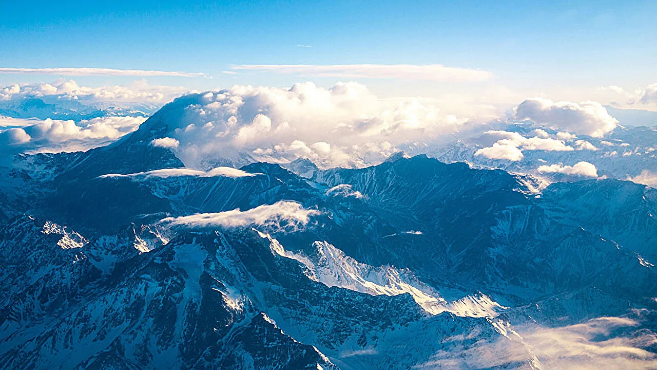
The Tibetan Plateau functions as the main water tower of Asia, supplying freshwater to hundreds of millions of people in surrounding river basins. Glaciers, alpine snowpacks, and seasonal precipitation all rely on stable atmospheric conditions over the plateau. When cloud heights and phases shift, precipitation patterns change across valleys that depend on steady river discharge for drinking water, crop irrigation, and seasonal reservoir replenishment [1]. Altered snowfall timing can cause river headwaters to swell unpredictably during spring months while reducing dependable water availability during summer droughts. Snowpack is already diminishing across High Asia. Because of this trend, shifts in cloud structure add fresh vulnerability to regional water supplies [2].
Diminishing snow storage forces regional water authorities to adapt irrigation schedules and flood prevention plans. If clouds produce warm-liquid rain instead of snow at high elevations, winter storage drops and runoff arrives earlier in the season [1]. Downstream farming depends on river timing. These hydrological disruptions threaten agricultural output in downstream nations, where farming seasons align with historical river flows [2].
Better atmospheric simulation tools are required to predict how mountain clouds will influence water security in coming decades. Scientists who couple observational cloud data with advanced aerosol simulations in climate forecasts can better predict how airborne particles and regional heat interact over rugged terrain [1]. Without accurate representations of cloud ascent over high topography, hydrological projections will struggle to anticipate changing water supplies [2].
Radiative Balance in Earth’s Upper Atmosphere
Beyond regional water security, ascending clouds over the Tibetan Plateau and the Andes carry important implications for global energy balances. Clouds play a dual role in Earth’s climate system: they trap outgoing thermal radiation from the surface while reflecting incoming solar radiation back into space, creating an intricate balance across alpine regions [2]. The net radiative effect depends on cloud height, optical thickness, and cloud phase. High, cold ice clouds tend to trap infrared heat effectively, whereas low-lying liquid clouds reflect solar energy back into space [1].
Zhang and coauthors said that further research must investigate how icy high-elevation cloud shifts influence regional radiative energy budgets [1]. Scientific editors Gaby Clark and Robert Egan at Phys.org reported the value of examining both high peaks and neighboring lowlands [3]. Because cloud tops over the highest mountain summits climbed into colder air layers, their radiative impact differs from clouds over low-lying terrain. Researchers must determine whether these rising mountain clouds create a net warming or cooling feedback as an important next step for climate science [2].
Future satellite observations and fine-scale atmospheric models will concentrate on these high-altitude cloud mechanisms. High summits demand dedicated models. As research supported by the American Geophysical Union expands, scientists hope to incorporate mountain cloud dynamics directly into global climate projections to refine how models capture topographic influences [2]. Refining these models helps ensure that future forecasts accurately represent how extreme topography shapes the skies above Earth’s highest peaks [1].
- ACADEMIC JOURNAL Zhang, Y., Wang, M., Zhu, Y., Rosenfeld, D., Liu, J., & Wu, X. (2026). Amplified Cloud‐Phase Responses Over Global Mountain Regions Under Climate Warming. AGU Advances, 7(6). [Article Link]
- ONLINE NEWS Dzombak, R. (2026). Clouds over the highest mountains dance a little differently. Eos, 107. [Article Link]
- ONLINE NEWS Dzombak, R. (2026). Supercooled clouds over the highest mountains respond differently to climate change. Phys.org. [Article Link]
APA 7: PerEXP Teamworks. (2026). Global Peaks Trigger Unusual Ascent in Mountain Clouds. PerEXP Teamworks.


