




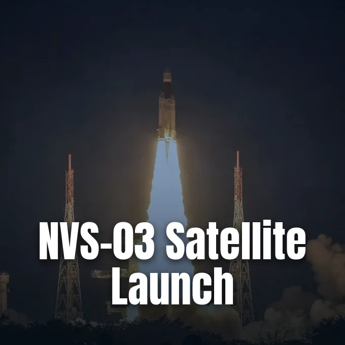
The Indian Space Research Organisation launched the NVS-03 satellite aboard a GSLV-F18 rocket from Sriharikota on Friday night, sending the spacecraft into an elliptical transfer path to upgrade India’s regional positioning fleet. Liftoff took place at 11:51 p.m. Indian Standard Time from the Second Launch Pad at the Satish Dhawan Space Centre in Andhra Pradesh. The mission adds a fourth working spacecraft to the NavIC network, meeting the minimum number of satellites needed to supply continuous location and time data for users [5].
Night Liftoff from Sriharikota
Standing 50 metres tall on the launch pad, the three-stage GSLV-F18 rocket lifted off with a total mass of 420 tonnes after a 24-hour countdown. The rocket burned through its lower stages to push the 2,250-kg payload into space before releasing it about twenty minutes after engine ignition. Ground stations locked onto telemetry right after separation [5].
The flight marked the 14th mission for India’s GSLV Mark II launch vehicle, a three-stage rocket that stands 52 metres tall and first flew in 2010 to replace the earlier Mark I model that retired after six flights and two failures. Twelve of those 14 Mark II flights have flown without incident. Friday’s flight also was the fourth orbital launch conducted from Indian territory during 2026, with three missions flown by ISRO and one conducted in July by Skyroot Aerospace, the first private aerospace firm in India to reach Earth orbit. Skyroot reached orbit three months earlier from the same spaceport [1].
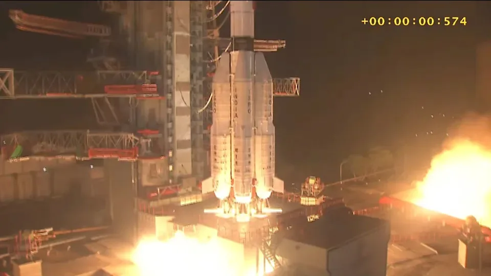
Friday’s flight was the 20th mission overall for the broader GSLV family, which has now delivered a cumulative payload of 34 tonnes into space. The mission also set the shortest turnaround time on record for the vehicle, returning to the launch pad 56 days after GSLV-F17 placed the EOS-05 Earth observation satellite into space on September 4 [4].
Why the NVS-03 Satellite Restores NavIC
India built the Navigation with Indian Constellation, known as NavIC, to provide sovereign Position, Navigation and Timing (PNT) signals for civilian and government users. In the launch brochure for the flight, ISRO described the network as “a regional navigation satellite system designed to provide accurate Position, Navigation and Timing (PNT) service to users in India as well as the region extending about 1,500 km [930 miles] beyond the Indian landmass, which is its primary service area”. The regional system needs a baseline quorum of four working satellites in orbit to calculate user positions through radio geometry, but prior to Friday only three spacecraft remained operational. That deficit limited coverage reliability for ground users [2].
ISRO Chairman V Narayanan followed the ascent from the control centre in Sriharikota. He said, “The Navic constellation is now strengthened and restored in orbit. This is a national strategic asset to position the satellite in the intended orbit. This is important for one nation one time project. Indigenously developed with indigenous clocks it will help in tracking trains, aircrafts, ships and other civilian applications” [5].
Civil L1 Signals and Rubidium Clocks
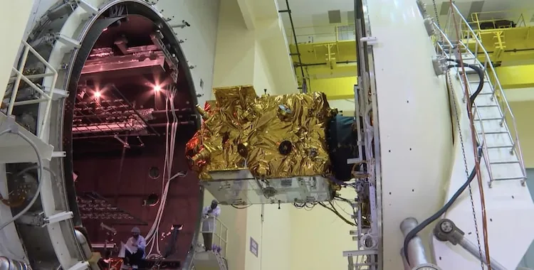
Beyond expanding fleet numbers, the new spacecraft upgrades the hardware carried aboard India’s navigation satellites. The NVS-03 satellite carries an indigenously developed Rubidium atomic clock along with imported timing units to improve positioning accuracy and build domestic capability in precision timing technology. Precise timekeeping forms the backbone of every satellite navigation fix, because a timing discrepancy of even a few nanoseconds between atomic clocks can shift a calculated position on the ground by several metres. Relying on domestic clocks protects the satellite network against overseas hardware trade restrictions. Engineers designed the internal Rubidium standard to maintain picosecond stability under harsh orbital temperature swings [3].
Navigation constellations rely on synchronised timekeeping, where ground receivers determine their exact coordinates through radio signals timed by atomic clocks, a principle detailed in an overview of how satellite clocks calculate location. By comparing arrival times from multiple satellites, a phone receiver pinpoints its position on Earth.
The satellite also introduces the civil L1 frequency band, adding it to the L5 and S-band signals broadcast by older spacecraft. Because commercial chips in smartwatches, fitness trackers and mobile phones already track the L1 band used by global networks, this signal allows everyday consumer electronics to receive NavIC data without extra radio hardware. The addition broadens civilian use for road transport, maritime warnings and disaster alerts [3].

Lessons Learned from NVS-02 Valve Failure
The flight succeeded after a major setback in January 2025, when the earlier NVS-02 satellite failed to reach its planned operational orbit. Although the GSLV-F15 launch vehicle placed that spacecraft into its planned transfer orbit, an electrical fault in a pyrotechnic valve prevented oxidiser from reaching the Liquid Apogee Motor. Without thrust from its main engine, the spacecraft could not perform the needed orbit-raising burns and remained stranded in an elliptical transfer orbit, unable to join the active fleet. Flight controllers monitored the stranded satellite for weeks before concluding that its orbit could not be corrected [3].
To prevent the same valve problem from happening again, ISRO redesigned the electrical activation sequence for the pyrotechnic propellant valves before the flight [7]. Technicians verified the valve mechanisms to make sure oxidiser flows reliably during liquid engine burns. These changes also set the engineering baseline for the upcoming NVS-04 and NVS-05 satellites, which will complete the second-generation constellation [3].
Orbit Insertion for the NVS-03 Satellite
The GSLV-F18 third stage injected the spacecraft into an elliptical Geosynchronous Transfer Orbit (GTO) with a perigee of 170.3 kilometres and an apogee of 38,080 kilometres, inclined at 20.75 degrees to the equator. Chairman Narayanan praised the guidance accuracy achieved by the rocket in a statement after liftoff. He said, “I am delighted to announce the successful launch of placing the 2250kg launch vehicle in the intended orbit. It has reached 170.3km/38,080km. It’s a precise launch and the best performance achieved so far”. Downrange tracking radars confirmed that the satellite entered the target flight corridor [5].
Over the coming days, the spacecraft will use its onboard liquid propulsion system to carry out several orbit-raising burns, moving the NVS-03 satellite toward its final geosynchronous slot at 32.5 degrees East longitude. Controllers confirmed that the solar panels deployed and that telemetry shows good platform health, with information relay expected to begin within a week [5].

Union Minister of State for Science and Technology Dr Jitendra Singh praised the space agency for the flight, while team members celebrated at the launch centre in Andhra Pradesh. Agency engineers pointed out that the flight proved the cryogenic upper stage worked as intended under night launch demands. The smooth insertion completed a clean recovery from past launch anomalies [7].
Building India’s Sovereign Navigation Network
The launch supports India’s wider effort to build sovereign space-based infrastructure and reduce strategic dependence on foreign navigation systems like the American GPS and Russian GLONASS. Because global navigation networks are owned by foreign defense ministries, access can be restricted or downgraded during international disputes, creating serious risks for domestic communications and military operations. By providing regional coverage across the mainland and extending 1,500 kilometres beyond its borders, India keeps critical navigation tools under its own control. The coverage zone shields busy commercial shipping lanes across the northern Indian Ocean and supports disaster response during tropical cyclones [6].
NavIC does not aim to replace global constellations worldwide, but it provides a regional alternative tailored to Indian territory and nearby waters. With the NVS-03 satellite now in orbit and two more second-generation spacecraft planned, ISRO has strengthened the foundation for tracking trains, marine vessels and commercial transport fleets across the subcontinent [7].
- ONLINE NEWS Wall, M. (2026, October 30). India launches next-gen navigation satellite to orbit (video). Space.com. [Article Link]
- ONLINE NEWS Wall, M. (2026, October 30). India launches next-gen navigation satellite to orbit (video). Yahoo Tech. [Article Link]
- ONLINE NEWS Tripathi, S. (2026, October 30). India gets its own GPS boost: Isro launches NVS-03 to strengthen homegrown navigation. India Today. [Article Link]
- ONLINE NEWS Kryshtovskyi, F. (2026, October 30). India launches NVS-03 navigation satellite into orbit — Space.com. UA.NEWS. [Article Link]
- ONLINE NEWS Express News Service. (2026, October 30). ISRO launches GSLV-F18 carrying next-generation navigation satellite NVS-03. The New Indian Express. [Article Link]
- ONLINE NEWS Sobhan, S. (2026, October 30). India news: Space agency to boost GPS alternative with new satellite. Deutsche Welle. [Article Link]
- ONLINE NEWS Kapoor, R. (2026, October 31). ISRO NVS-03 Launch News: GSLV-F18 places Next-Gen Navigation satellite in orbit, strengthening NavIC. Organiser. [Article Link]
APA 7: PerEXP Teamworks. (2026, October 31). ISRO Launches NVS-03 Satellite to Restore NavIC Fleet. PerEXP Teamworks. https://perexpteamworks.com/en/nvs-03-satellite-launches-navic-fleet/


