






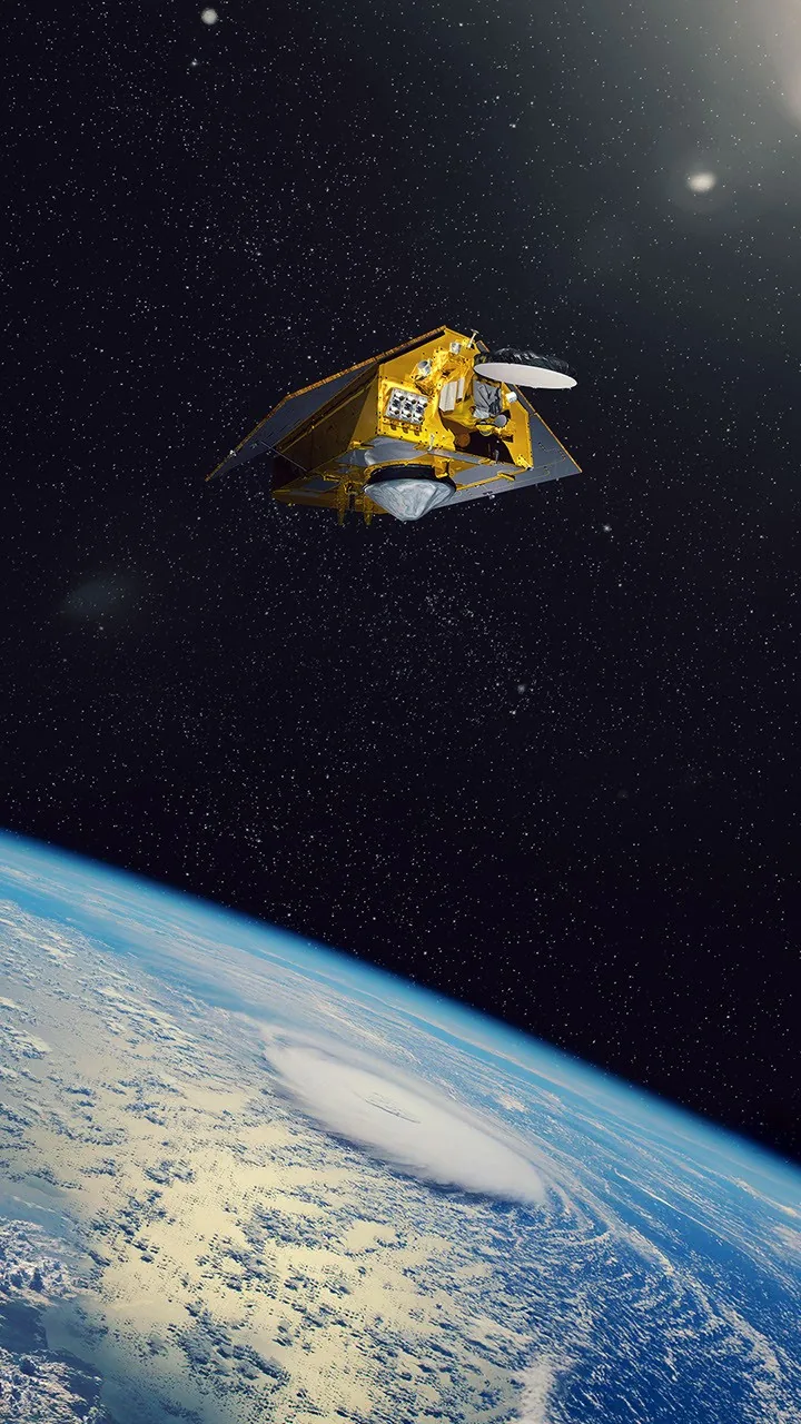
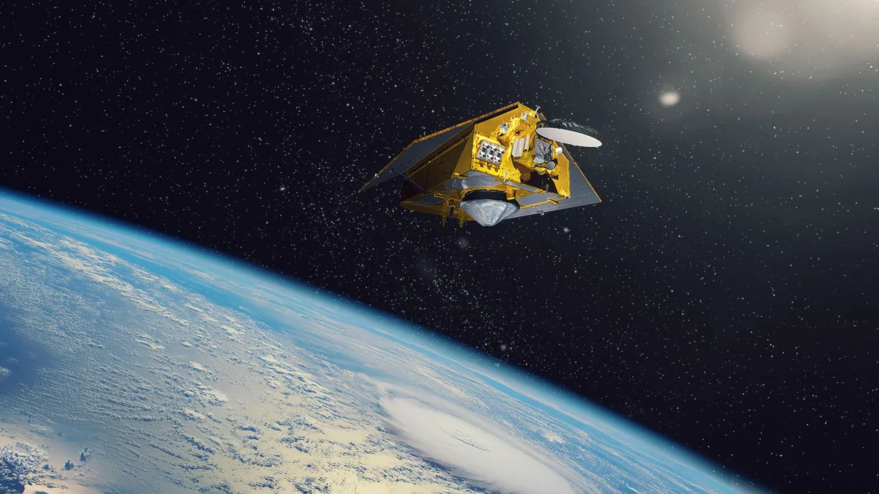
NASA and international partners released new imagery on November 16, 2026, showing the Sentinel-6B satellite operating in Earth orbit. The spacecraft serves as the reference satellite for missions that measure sea surface height around the globe [1]. Scientists track these altimetry readings to see how ocean waters store and redistribute heat, water, and carbon within the climate system. High-precision measurements from orbit help weather forecasters monitor ocean circulation patterns while giving coastal planners reliable records of global sea level change over extended periods [2].
NASA Visualizes the Sentinel-6B Satellite in Flight
Rafael Alanis and Anil Natha prepared the release for the NASA Science Photojournal under catalog entry PIA26803, presenting an artist concept that shows the Sentinel-6B satellite flying in its planned orbital position above Earth. JPL-Caltech credited the visualization to international oceanographic teams. The work provides baseline standards for global research. Two companion drawings, cataloged as Figure A and Figure B, show the spacecraft layout and observation geometry in detail [1].
The spacecraft entered service with a planned operating lifespan of 5.5 years to map global ocean elevation with millimeter precision. Known as Sentinel-6B (S6B), it forms part of the Copernicus Programme and the Jason satellite series. Its assignment supports marine forecasting and climate monitoring. Beyond open seas, the synthetic-aperture radar package improves topography measurements for inland waterways, including rivers and lakes. Its position as a reference platform allows companion observation missions to match a shared calibration standard, maintaining high data reliability for research teams studying planetary water cycles. It gathers these measurements continuously so that public agencies can detect subtle shifts in ocean currents, seasonal water storage, and coastal sea levels without suffering data interruptions [2].
Launch Campaign from California to Orbit
SpaceX launched the spacecraft aboard a Falcon 9 rocket from Space Launch Complex 4E, designated SLC-4E, at Vandenberg Space Force Base in California at 5:21 UTC on November 17, 2025. The flight used booster B1097.3. That specific first stage previously flew twice during 2025 on commercial Starlink missions. After staging, booster B1097.3 flew back to California and landed on Landing Zone 4. The rocket’s second stage continued climbing, releasing the satellite just under an hour after liftoff [2].
Ground controllers at the European Space Operations Centre, known as ESOC, received the first radio signal from Sentinel-6B at 6:54 UTC through the Inuvik ground station in northwestern Canada. Power systems stabilized quickly. On November 20, 2025, the Mission Control Centre operated by EUMETSAT in Darmstadt, Germany, took official control of the spacecraft. Orbit validation began when the Poseidon-4 altimeter captured initial data on November 26, 2025. The European Space Agency published these early results on December 16, 2025, comparing them with observations collected over the same ocean region by Sentinel-6 Michael Freilich [2]. Both spacecraft recorded matching sea surface levels.
Satellite Journey from Bremen to California
Engineers tested the airframe in Europe. During 2025, Sentinel-6B underwent environmental checks at the IABG facility in Ottobrunn, Germany, where teams simulated launch acoustic vibration and thermal vacuum conditions. Technicians then trucked the hardware to Bremen, Germany. In July 2025, the cargo vessel Industrial Dolphin carried the container over the Atlantic Ocean to the port of Galveston, Texas. The ocean crossing preserved sensitive optical and radar components [2].
Ground transport teams moved the container by road from Texas to Vandenberg Space Force Base in California, where the convoy arrived safely in late August 2025. Workers transferred the satellite to Astrotech Space Operations on September 24, 2025. Crews unpacked the Sentinel-6B satellite on October 1 to begin fueling and alignment checks. At the European Space Operations Centre, teams started Launch and Early Orbit Phase simulations on September 2, 2025, rehearsing emergency recovery procedures. Technicians encapsulated the satellite inside the Falcon 9 payload fairing on November 10, 2025, after completing integrated electrical checks. On November 15, the flight passed its official Launch Readiness Review, giving mission directors final approval for liftoff [2].


Radar Altimetry and Onboard Instrumentation
The central payload instrument is POSEIDON4. The European Space Agency developed this radar altimeter from the Sentinel-3 SRAL architecture to support ocean topography and inland river monitoring. POSEIDON4 operates in an interleaved mode combining high-resolution synthetic-aperture radar tracking with low-resolution pulse-limited altimetry. This architecture measures open sea elevations while also resolving narrow coastal waters, rivers, and lakes. To correct for atmospheric water vapor delays, NASA provided the Advanced Microwave Radiometer, designated AMR-C, which measures moisture in the radar path [2].
Precise orbit determination requires three complementary navigation systems. The European Space Agency built the GNSS POD receiver from Sentinel-3 heritage hardware to track satellite constellations in medium Earth orbit. It operates with a DORIS receiver, identical to hardware flown on Jason-3 and Sentinel-3, which measures radio signals from ground beacons to calculate orbital velocity with extreme precision. NASA supplied a Laser Reflector Array, designated LRA, together with a Tri-G receiver for GNSS radio occultation measurements. Flight teams use these integrated packages to deliver centimeter-scale satellite positioning for every altimeter pulse [2].
How the Sentinel-6B Satellite Extends Ocean Records
Global altimetry records began on August 10, 1992. On that date, NASA and CNES launched the joint TOPEX/Poseidon mission to measure planetary ocean circulation, thermal expansion, and regional sea surface height variations from low Earth orbit. Earlier oceanographers relied on scattered coastal tide gauges and sparse ship surveys. The Sentinel-6 program continues this legacy as the direct successor to the Jason satellite series [2].
Under this cooperative framework, the Sentinel-6B satellite was constructed as an identical companion to Sentinel-6 Michael Freilich, which reached low Earth orbit on November 21, 2020. Twin satellites in orbit keep measurement quality steady while extending global records past 2030. When combined with earlier Jason missions, these spacecraft will secure nearly forty years of continuous observations tracking climate-driven sea level rise and changes in major ocean currents. Climate scientists rely on these decadal baselines to isolate natural oscillations from long-term ocean warming. For the next decade, international partners plan to launch Sentinel-6C during the 2030s to maintain the Copernicus ocean altimetry timeline. Overlapping missions prevent data gaps [2].

International Partnership Behind Copernicus
International cooperation underpins the Sentinel-6 mission. The European Space Agency managed spacecraft construction within the Copernicus Programme under the direct leadership of the European Commission. From Darmstadt, Germany, EUMETSAT commands the satellite and delivers calibrated altimetry products to European and global weather centers. In the United States, NASA and NOAA supply flight instruments, launch facilities, and oceanographic data processing, while France’s space agency, CNES, provides engineering support for orbital altimetry systems [2].
Financial backing from the European Commission keeps all altimetry findings freely accessible to the public. Meteorological agencies use these sea surface readings to evaluate upper ocean heat content, helping forecasters anticipate tropical storm intensity and seasonal weather shifts. Coastal offices rely on the data. Engineers incorporate these altimetry records into regional models for port expansion, sea walls, and flood barriers. Through open scientific networks, this international partnership equips researchers, emergency managers, and local communities with trustworthy measurements of shifting sea levels. Sentinel-6B demonstrates that sustained cooperation among ESA, NASA, NOAA, and EUMETSAT delivers the environmental observations required to understand planetary change [2].
- WEBSITE Alanis, R., & Natha, A. (2026). Sentinel-6B in orbit around Earth. NASA Science. [Article Link]
- WEBSITE Wikipedia contributors. (2025). Sentinel-6B. Wikipedia, The Free Encyclopedia. [Article Link]
APA 7: PerEXP Teamworks. (2026, November 17). Sentinel-6B Satellite Takes Orbit as Ocean Topography Reference. PerEXP Teamworks. https://perexpteamworks.com/en/sentinel-6b-satellite-earth-orbit/


