





Every day, billions of devices find their position on Earth by reading radio pulses sent from space. Modern gps technology relies on an orbiting fleet of craft carrying atomic clocks that beam precise time stamps and orbital path data down to the ground [1]. A small receiver compares arrival times from multiple orbiters to calculate exact distance. Handheld mobile phones, maritime cargo ships, and commercial transport airliners use these incoming signals to determine their latitude, longitude, and elevation anywhere across the globe [2].
- How Does GPS Technology Work?
- Trilateration Using Satellite Distance Signals
- How GPS Technology Coordinates Three Segments
- Cold War Roots and Civilian Access
- Why Relativistic Clock Shifts Occur
- Atmospheric Interference and Clock Drift
- Everyday GPS Technology in Modern Industry
- Upgrading Orbital Fleets for Space Exploration
How Does GPS Technology Work?
Orbiting craft broadcast radio signals that report their location in space and the exact moment each pulse left the antenna. The fleet flies in Medium Earth Orbit at an altitude of about 20,200 kilometers, or roughly 12,550 miles above the ground [1]. Radio waves travel at the speed of light, which is about 300,000 kilometers per second, so a tiny delay occurs before pulses reach an antenna on Earth [5]. This elapsed travel time reveals the distance between the spacecraft and the user [2]. That single distance places the user on the surface of a wide sphere centered on the craft [5]. One sphere leaves millions of possible ground points unresolved [3].
A second orbiter creates an intersecting circle between two spheres, narrowing possible spots along a circular perimeter [5]. When a third craft joins the calculation, the intersecting shapes shrink those possibilities down to two discrete points in space [2]. One point sits far out in space, which leaves a single valid spot on Earth [3].
A fourth craft is needed because user devices carry simple quartz clocks that drift and introduce time offsets that disrupt range math [2]. When a device locks onto at least four satellites at once, it solves a system of equations with four unknown values: latitude, longitude, altitude, and internal clock bias [5]. This step eliminates the need for an expensive atomic clock inside a pocket phone. Personal devices use gps technology to compute coordinates accurate to within five meters without heavy hardware [4]. Without that fourth signal, clock errors would corrupt readings by several miles [5].

Trilateration Using Satellite Distance Signals
At its core, gps technology calculates position through trilateration, which relies on sphere radii rather than angles [5]. Each orbiter sends a repeating digital code on the L1 carrier wave [1]. The user receiver builds an identical digital code locally to check the time shift. The aligned pulse patterns reveal the travel delay [5].
Modern chipsets measure the offset between radio codes with precision down to a hundredth of a single pulse width, which yields a time offset of roughly 10 nanoseconds for the civilian coarse acquisition code. Because radio waves travel at light speed, a 10-nanosecond shift equals a distance gap of about three meters along the line of sight. Military equipment tracking the higher-frequency P(Y) signal achieves tighter resolution, which narrows code timing uncertainty down to thirty centimeters [5]. In dual-frequency civilian units, comparing phase shifts across both carrier waves allows survey equipment to achieve centimeter-level fixes by checking wave peaks against known reference points [4], [5]. High-end geodetic stations at Dahlgren Naval Proving Ground and universities even reach millimeter precision during long survey runs [4].
Fleet geometry in the sky strongly shapes calculation quality through a metric called dilution of precision. When visible orbiters cluster close together in one small patch of sky, their range spheres cross at shallow angles that increase position uncertainty across all three dimensions. When the orbiters spread broadly across the sky, their spheres cross at steep angles. This geometry produces low dilution values and dependable coordinates [5].
How GPS Technology Coordinates Three Segments
The operational architecture of gps technology functions through three main divisions: the space segment, the control segment, and the user segment. The space segment consists of the orbiting fleet, which nominally contains 24 working craft distributed across six orbital planes inclined at 55 degrees relative to the equator [1]. Each plane maintains at least four craft traveling at about 14,000 kilometers per hour in Medium Earth Orbit [2], [3]. They circle Earth every 12 hours [2],. This orbital layout ensures that an observer with an open sky view can see between six and twelve craft from almost any spot on the planet at any hour [3]. Space Force crews keep extra craft in orbit as active spares [2].
The control segment tracks and maintains the orbital fleet from stations on Earth. Operated by the United States Space Force through Mission Delta 31, ground crews follow orbital paths, monitor clock accuracy, and upload updated navigation files each day [1], [4]. These daily uplinks correct minor deviations in satellite paths [1].
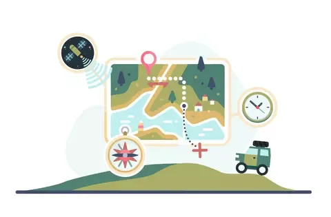
The user segment includes all civilian and military antennas that process incoming radio messages from space [1]. Because user devices operate purely as listen-only radios, they do not beam signals back to orbit. Millions of people can navigate at the same time without clogging the network [4]. Civilians tap the Standard Positioning Service on the L1 channel without fees. Armed forces and allied defense teams rely on the Precise Positioning Service across two frequencies for greater resistance against radio jamming [1].
Cold War Roots and Civilian Access
Satellite navigation began during the Cold War following the launch of Sputnik 1 in 1957. Physicists William Guier and George Weiffenbach at the Johns Hopkins Applied Physics Laboratory tracked the Soviet orbiter using radio Doppler shifts. Deputy director Frank McClure realized the same math could track American Polaris submarines. That work produced the Navy TRANSIT system [4].
The early growth of gps technology addressed military needs to guide strategic bombers and submarine missiles. Key inventors Roger L. Easton of the Naval Research Laboratory, Ivan A. Getting of The Aerospace Corporation, and Bradford Parkinson of the Applied Physics Laboratory guided the core engineering concepts. At the Dahlgren Naval Proving Ground, mathematician Gladys West built geodetic Earth models that mapped local gravity variations, giving teams the math needed to calculate orbits. In 1973, Pentagon leaders merged Navy and Air Force research into the Navstar program, drawing upon earlier Timation satellites [4]. The first prototype orbiter launched in 1978, and the constellation reached service readiness in 1993 [1],. Defense deterrence funded the early space launches [4].
Civilian access widened after Soviet fighters shot down Korean Air Lines Flight 007 near Sakhalin Island in 1983, prompting President Ronald Reagan to open the network to commercial planes. The military initially degraded public signals through Selective Availability, limiting civilian receivers to an error margin of 100 meters. On May 1, 2000, the United States government disabled Selective Availability, instantly improving civilian precision to five meters. This executive action opened the path for consumer mapping tools [4].


Why Relativistic Clock Shifts Occur
Operating orbital navigation calls for solving relativistic time shifts predicted by theoretical physics. Craft circle Earth at speeds of about 14,000 kilometers per hour. Under Special Relativity, fast motion causes satellite atomic clocks to tick slower than ground clocks. These orbital clocks lose about 7 microseconds per day. Relative velocity dilates orbital time continuously [3].
General Relativity introduces an opposing effect because gravitational fields alter time, meaning clocks in weaker gravity run faster than clocks on the surface of the planet. Because the orbiters fly 20,000 kilometers above the ground, Earth’s gravitational pull is weaker at orbital altitude than on the ground. As a result, satellite atomic clocks gain about 45 microseconds every day compared to identical ground clocks. When physicists combine both relativistic factors, satellite clocks run faster by a net offset of roughly 38 microseconds per day, which represents 38,000 nanoseconds of drift. Without fixing this combined shift, position fixes would fail after two minutes of operation. Position errors would grow by 10 kilometers each day [3].
To prevent this drift from ruining position fixes, engineers adjust satellite clock frequencies before launch so they tick slightly slower on Earth. Once placed in orbit, the clocks speed up due to the weaker gravity and tick at the correct reference rate. Built-in microprocessors in phones and car units calculate any remaining relativistic variations dynamically. These physical corrections proved vital for making gps technology dependable for drivers and pilots worldwide [3].

Atmospheric Interference and Clock Drift
Radio signals traveling from space encounter atmospheric delays that affect distance calculations [4], [5]. The ionosphere, situated between 60 and 1,000 kilometers above the ground, contains charged plasma that bends and delays radio waves depending on solar activity. In 1974, Australian space researcher Elizabeth Essex-Cohen studied atmospheric refraction at the Air Force Geophysical Research Lab, helping create the Klobuchar model for ionospheric signal corrections [4]. Lower down in the troposphere, uncharged air molecules, water vapor, and temperature shifts slow down microwave signals. Dual-frequency receivers track two channels to measure and cancel these ionospheric delays directly. Single-channel devices rely on broadcast atmospheric models to estimate signal lag [5].
Multipath reflection causes additional errors when signals bounce off tall office towers, pavement, or hillsides before reaching an antenna [5], [8]. These bounced pulses travel longer paths, creating false arrival times that confuse receivers [5]. In rugged terrain, complementary tools like 3D mapping without moving mirrors show how direct optical instruments bypass radio reflections.
Where satellite signals remain blocked, ground-based positioning systems offer practical backups. In 1995, researcher R. Kyker at Lawrence Livermore National Laboratory published a report describing a local positioning system that tracked bicycles using electronic compasses and wheel sensors across distances under 90 miles without satellite reception [7]. More recently, an unreviewed preprint submitted to arXiv in May 2023 by J. C. J. Koelemeij and fellow researchers showed decimetre-level positioning using optical fibre networks to synchronize ground radio transmitters. These ground networks provide backup timing when sky views are blocked [8].
Everyday GPS Technology in Modern Industry
While vehicle routing and smartphone maps represent familiar tools, gps technology plays an essential role across global industries. In precision agriculture, farmers use satellite signals to guide tractors along field rows within centimeters, saving fuel and seed [2]. Civil surveyors rely on Real-Time Kinematic networks to measure boundary lines and bridge alignments [3], [4]. Satellite coordinates replace manual land surveys [5].
Beyond locating objects on maps, satellite fleets distribute precise time across telecommunication and financial networks. The National Institute of Standards and Technology conducts common-view GPS observations, allowing laboratories to synchronize distant atomic clocks by comparing simultaneous satellite receptions. Cellular networks depend on nanosecond time stamps to schedule wireless data packets and prevent signal overlap, while financial exchanges stamp millions of electronic trades every second to maintain transparent market audit trails. Electrical power distributors also rely on synchronized orbital time stamps to monitor alternating current phase angles along regional transmission grids, helping operators identify power surges and prevent widespread electrical blackouts. Atomic clocks in orbit keep ground networks synchronized. Orbital time distribution stabilizes modern power and banking grids [2].

Scientific teams and sports researchers apply satellite tracking in novel ways. Geologists monitor millimeter-scale plate tectonic drift and track volcanic swelling to forecast natural hazards before disasters strike. Sports analysts use wearable GPS units during professional team practices to monitor athlete sprint speeds, overall running distance, and physical load to prevent fatigue and soft tissue injuries [1]. Managing telemetry from ground tracking networks shares engineering principles with lunar ground stations designed for upcoming exploration missions.
Upgrading Orbital Fleets for Space Exploration
Ongoing modernization initiatives continue to upgrade the satellite constellation with advanced GPS Block III spacecraft [1],. These newer craft transmit the civilian L5 signal, which features a higher chipping rate on a protected frequency band that reduces signal interference and improves reception in difficult environments. As of March 2026, 21 satellites broadcast pre-operational L5 signals, with full 24-satellite capability scheduled for 2027 [4]. NASA is also adding laser retro-reflectors to new GPS spacecraft, partnering with the International Laser Ranging System (ILRS) to track satellite orbits with laser pulses from the ground. This laser tracking identifies subtle orbit errors, establishing an improved Earth-centered terrestrial reference frame accurate down to millimeters [1].
In high-altitude spaceflight, NASA applies gps technology to navigate robotic missions without constant ground tracking. The Navigator receiver proved successful during Hubble Space Telescope Servicing Mission 4 in May 2009, while eighteen BlackJack flight receivers support missions across Low Earth Orbit. Onboard processing cuts operating expenses and boosts spacecraft autonomy [1].
Global navigation has evolved into a multi-constellation ecosystem beyond American GPS [1],. Russia operates GLONASS, the European Union maintains Galileo, and China completed its BeiDou network in June 2020 [6]. Modern receiver hardware, including NASA’s TriG receiver, processes signals from multiple satellite constellations at the same time to improve tracking geometry and guarantee continuous coverage worldwide [1]. These automated navigation capabilities support future deep-space exploration, connecting straight to research on autonomous deep space decisions for autonomous probe operations.
- WEBSITE Manning, C. G. (2023, September 25). GPS: Global Positioning System. National Aeronautics and Space Administration. [Article Link]
- WEBSITE National Institute of Standards and Technology. (2025, February 24). How Do You Measure Your Location Using GPS? [Article Link]
- WEBSITE Pogge, R. (1996). Real-World Relativity: The GPS Navigation System. Ohio State University Department of Astronomy. [Article Link]
- WEBSITE Wikipedia contributors. (2026). Global Positioning System. In Wikipedia, The Free Encyclopedia. [Article Link]
- WEBSITE Wikipedia contributors. (2026). Error analysis for the Global Positioning System. In Wikipedia, The Free Encyclopedia. [Article Link]
- WEBSITE Wikipedia contributors. (2026). Positioning system. In Wikipedia, The Free Encyclopedia. [Article Link]
- REPORT Kyker, R. (1995, July 25). Local positioning system (Report No. UCRL-ID-121591). Lawrence Livermore National Laboratory. [Article Link]
- PREPRINT Koelemeij, J. C. J., Dun, H., Diouf, C. E. V., Dierikx, E. F., Janssen, G. J. M., & Tiberius, C. C. J. M. (2023). A hybrid optical-wireless network for decimetre-level terrestrial positioning. arXiv. [Article Link]
- WEBSITE National Coordination Office for Space-Based Positioning, Navigation, and Timing. (2026, June 16). What is GPS? [Article Link]


