






How far can a dust storm from Africa travel as summer fades? NASA’s Terra satellite captured dust over Mali and neighboring countries on September 5, 2026. Later satellite views showed particles moving toward the Atlantic. NASA atmospheric scientist Tianle Yuan links storms of this kind to haboobs (powerful dust storms driven by strong convective winds). NASA considers a complete Atlantic crossing unlikely for this African dust storm.
Dust Storm from Africa: What Happened?
NASA’s Terra satellite recorded the plume with MODIS (the Moderate Resolution Imaging Spectroradiometer). Kathryn Hansen featured the September 5 view in NASA Earth Observatory’s September 10 account. The image date matters. The report describes a storm already underway several days before publication, followed by observations of particles spreading farther west. It does not describe a new storm beginning on September 10. NASA identifies Mali and neighboring countries as the area beneath the plume, without naming those neighboring countries in the account. [1] Here, the question is how winds lift and transport loose sediment over Mali; the Anak Krakatau eruption account examines volcanic ash.
Lauren Dauphin produced the Earth Observatory image using MODIS data from NASA EOSDIS LANCE and GIBS/Worldview. NASA credits the image processing and the written account separately, while Yuan supplies the atmospheric interpretation. Each contribution answers a different question. Terra supplies the dated observation; the subsequent satellite view establishes westward movement. Yuan explains the weather processes that can produce such plumes. NASA gives no dust mass, surface wind speed, or measured plume height. Those quantities remain outside what this account establishes.
NASA Earth Observatory documented an earlier dust storm from Africa in Africa Sheds Some Dust, Michael Carlowicz’s June 2021 account. Mali appears in both reports. In the earlier event, winds carried Saharan particles from Mali and Mauritania over Senegal, The Gambia, and Cabo Verde, while the NASA-NOAA Suomi NPP satellite captured the scene on June 4. Its VIIRS instrument supplied the image. By June 7, NASA’s time-lapse showed dust well over the central Atlantic. Those named countries describe the 2021 route. They do not fill the gaps in the September 2026 account, which identifies neighboring countries without naming them. [2]

What Lifts Dust over Mali?
Tianle Yuan, an atmospheric scientist at NASA’s Goddard Space Flight Center, says storms like the Mali event often accompany haboobs. Strong convective winds drive these powerful dust storms, lifting loose sediment into the air. Satellites can follow the resulting plumes over broad areas. Wind provides the lifting force. Sediment provides the material. Yuan’s explanation connects the visible dust with a plausible weather mechanism, although NASA does not present an event-specific analysis demonstrating that a particular convective storm caused every part of this plume. [1]
In Tianle Yuan’s account, available sediment and winds capable of lifting it work together. A dry surface alone does not determine whether a large plume develops. Drier conditions can increase the amount of loose material available. Strong storms can then send that material airborne. NASA’s description supports a physical explanation for storms of this kind. The precise sequence over Mali remains unresolved. A satellite view of suspended dust cannot, by itself, establish the contribution of each process at the ground.
Why Can Storms Outlast Summer?
West Africa’s dust activity generally declines as summer winds down, according to NASA Earth Observatory, yet the September image shows that the seasonal slowdown still allows individual storms to develop. Summer has no abrupt cutoff. A dust storm from Africa can occur while the region’s broader activity is easing, because the regional pattern describes a tendency rather than a rule for every day. NASA places the Mali plume in precisely that late-season setting. It does not call the event unprecedented or identify it as a record. [1]
NASA also describes a seasonal pattern in how far African dust travels. Late spring and summer favor complete journeys across the Atlantic. During that period, the Saharan Air Layer can transport particles westward at high altitudes. Convective winds can lift dust, while atmospheric conditions farther aloft help carry it away. The timing of the Mali event helps explain NASA’s cautious assessment of its prospects over the ocean. September conditions do not necessarily prevent every crossing.
NASA’s 2021 account also follows research by Bing Pu and colleagues at the University of Kansas into the atmospheric circulation behind the June 2020 dust episode. Bing Pu’s team combined satellite observations and ground measurements. They examined how successive wind systems could carry dust toward the Caribbean and the United States. Winds along the route matter. A dust storm from Africa can have a different destination even when its initial source region overlaps an earlier event. [2]
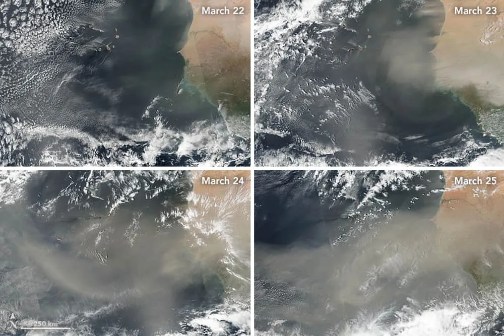
Chakraborty and colleagues extended the atmospheric-river concept to aerosols in Geophysical Research Letters. [3] Francis and colleagues examined exceptional Saharan dust transport toward Europe in Atmospheric Research. [4] Both papers address transport mechanisms; neither analyzes the September Mali event.


Will the Dust Cross the Atlantic?
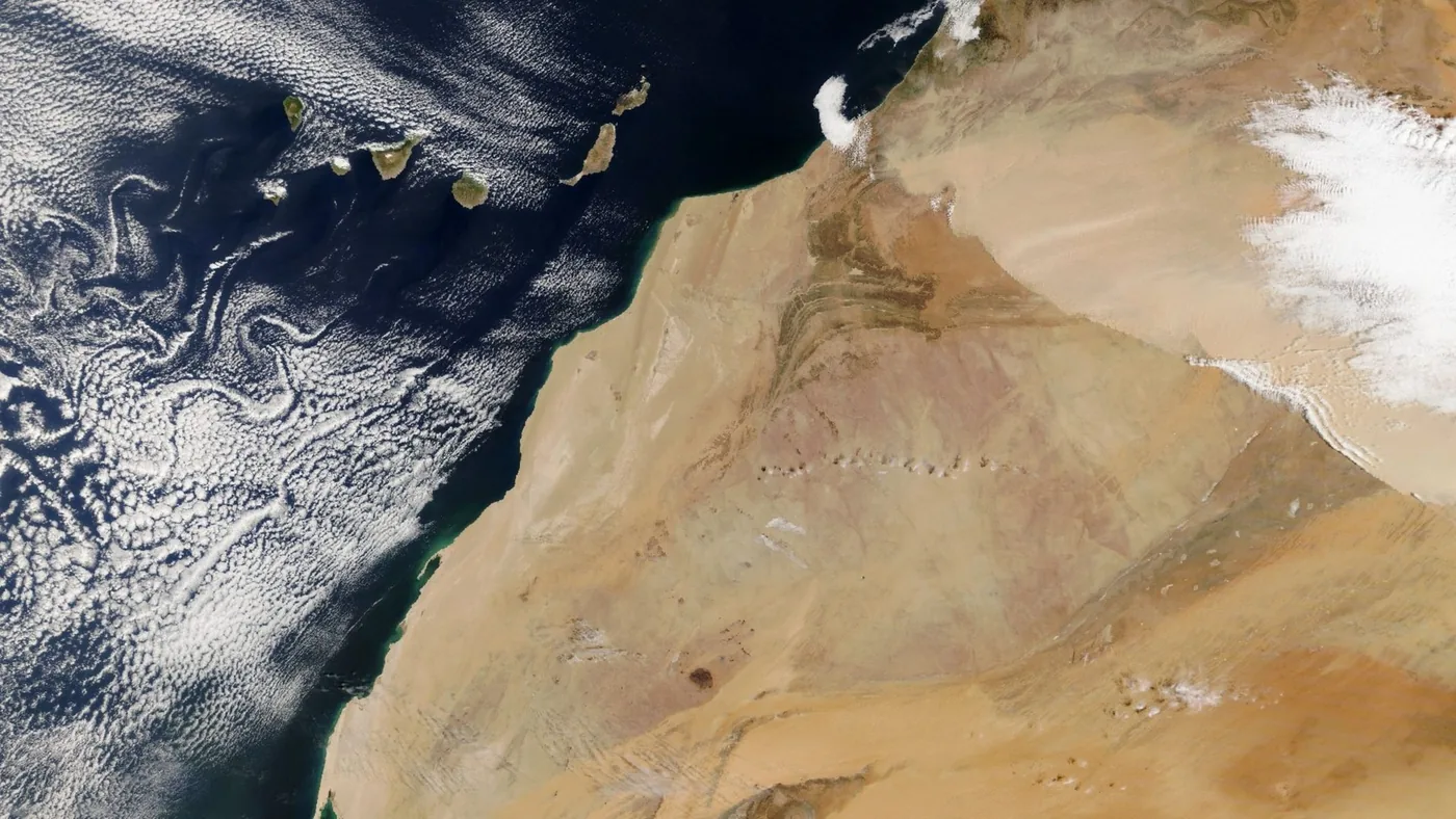
NASA reports that a wider satellite view in the days after September 5 showed aerosols (particles suspended in the air) moving westward from the region and extending over the Atlantic Ocean. That movement was observed. A complete ocean crossing remains a separate question. For this dust storm from Africa, NASA considers a full transatlantic journey unlikely. The particles had already reached the ocean. NASA gives no probability or predicted arrival date on the other side. It identifies no destination in the Americas. [1]
The Saharan Air Layer is a dry, dusty air mass. It can transport African dust thousands of miles westward at high altitudes during the more favorable late-spring and summer period. Distance alone is not the explanation. NASA connects those longer journeys to the air mass and its seasonal transport pattern, rather than treating every plume leaving the African coast as the beginning of a complete crossing. The later satellite view establishes the initial oceanward progress of the September particles. NASA does not trace their entire remaining route. Julian Marks describes Caribbean, South American, and European routes in Geography Realm. [5] PerEXP Teamworks also covers a different Atlantic journey in its account of butterflies crossing the ocean.
NASA’s assessment is probabilistic: a complete crossing is unlikely. The report does not establish where the final particles will settle.
Could El Niño Change Dust Activity?
Yuan identifies the developing El Niño as a possible influence on future dust patterns over the Sahel and Mali, through shifts in the Intertropical Convergence Zone and changes in convection. The report presents competing effects. Drier conditions can leave more loose sediment available for winds to lift, increasing the supply of potential dust. Reduced convective activity, however, can mean fewer intense haboobs capable of launching large plumes. More available sediment does not guarantee more airborne dust. The outcome depends on how those processes combine. NASA provides no calculation showing which influence will dominate in Mali as El Niño develops. [1]
El Niño cannot serve as a complete explanation for this dust storm from Africa on the evidence NASA presents. Yuan discusses a possible connection between a larger climate phenomenon and the regional processes that generate dust. He does not attribute the September 5 event to it. Drier conditions would also influence dust availability in future Sahel storms. Any accompanying change in convection would affect the winds that launch plumes.
What Remains Uncertain about This Storm?
Yuan states the attribution problem directly: “The connection can be real,” he says of El Niño, “but hard to pin down for individual events.” NASA’s account combines a satellite observation with Tianle Yuan’s explanation. It presents no separate event-attribution study establishing an El Niño contribution to the Mali storm. The plume is documented. Its westward movement is documented too. The larger climate explanation remains conditional. NASA’s expectation of an incomplete Atlantic crossing remains a forecast rather than a finished track. [1]
NASA leaves an open question about the region’s next dust episodes: will any increase in available sediment outweigh a reduction in the convective storms that lift it? Yuan’s explanation allows either influence to matter. For Mali and the wider Sahel, resolving their relative importance would require more evidence. The September image and subsequent account of oceanward movement do not provide it. NASA leaves unresolved how surface conditions and storm activity will combine as the developing El Niño affects the region.
- WEBSITE Hansen, K. (2026, September 10). Dust storm sweeps over Mali. NASA Earth Observatory. [Article Link]
- WEBSITE Carlowicz, M. (2021, June 8). Africa sheds some dust. NASA Earth Observatory. [Article Link]
- ACADEMIC JOURNAL Chakraborty, S., Guan, B., Waliser, D. E., da Silva, A. M., Uluatam, S., & Hess, P. (2021). Extending the Atmospheric River Concept to Aerosols: Climate and Air Quality Impacts. Geophysical Research Letters, 48(9). [Article Link]
- ACADEMIC JOURNAL Francis, D., Fonseca, R., Nelli, N., Bozkurt, D., Picard, G., & Guan, B. (2022). Atmospheric rivers drive exceptional Saharan dust transport towards Europe. Atmospheric Research, 266, 105959. [Article Link]
- WEBSITE Marks, J. (2022, March 17). Geography of Saharan dust: Where and how does it travel? Geography Realm. [Article Link]
APA 7: TWs Editor. (2026, September 10). How far can a dust storm from Africa travel beyond Mali? PerEXP Teamworks.


