






Does fast Arctic warming reshape northern terrain faster than climate models predict? In subarctic Alaska, hillslope erosion increases two to three times when solid frozen ground breaks apart into patchy permafrost. Polar temperatures are rising at four times the global rate, causing frozen slopes to slump and coastlines to collapse into the sea. Thawing soils disrupt northern ecosystems, release stored soil carbon, and threaten Indigenous communities living along subarctic waterways. A research team led by Emrah Özpolat examined lake sediment records from 12 Alaskan catchments to measure this geomorphic shift [1].
- How Does Permafrost Thaw Reshape Arctic Slopes?
- Hillslope Erosion Contrasted Across Alaskan Catchments
- What Did Twelve Lake Sediment Cores Reveal?
- Diffusive Erosion Outpaces River Channel Transport
- Why Discontinuous Ground Triggers Higher Hillslope Erosion
- How Permafrost Degradation Alters Northern Watersheds
How Does Permafrost Thaw Reshape Arctic Slopes?
Northern landscapes are changing as air temperatures climb in the circumpolar north. When underground ice wedges melt, hillsides lose their soil cohesion and ground begins to slide downward into stream valleys. While related climate research shows how reduced Bering Sea ice linked to northern wildfire risks alters large-scale weather patterns, ground thaw physically reshapes local terrain in vulnerable subarctic catchments. Slumping ground carries mud, gravel, and organic debris toward river channels below [2].
Permafrost coverage is rarely uniform across the Arctic basin. Geologists classify permafrost into continuous and discontinuous regimes based on how much land stays frozen year-round. In continuous zones, permanently frozen ground underlies more than 90% of the surface area, creating a solid frozen layer. Discontinuous zones feature patchy permafrost that covers only 50% to 90% of the land area. This patchy spread leaves thawed channels where groundwater circulates freely during summer months, melting buried ground ice and causing overlying soils to slump down valley faces [2].
Landscape evolution models struggle to predict how fast these thawing slopes will degrade. Most existing models rely on rough estimates rather than field data from real watersheds. Rebecca Dzombak reported for Phys.org that measuring hillslope erosion dynamics helps scientists understand changing Arctic landforms [2].
Hillslope Erosion Contrasted Across Alaskan Catchments
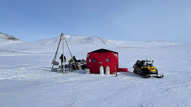
To resolve how ground ice coverage controls hillslope erosion, the research group focused on two distinct Alaskan regions with contrasting permafrost conditions. In the north, they studied catchments around Toolik Lake, where cold conditions keep permafrost continuous over more than 90% of the landscape. In southern subarctic Alaska, the researchers sampled catchments situated near Delta Junction, where discontinuous permafrost underlies between 50% and 90% of the surrounding terrain beneath boreal forest cover [1]. Toolik sits further north. Delta Junction lies south.
Both study areas share similar glacial landforms, which allowed the team to isolate permafrost as the main variable influencing soil movement. Near Toolik Lake, cold subsoil stays frozen close to the surface during the brief Arctic summer, which limits soil slipping and preserves stable slope shapes over time. Around Delta Junction, warmer mean temperatures create a deeper active layer that thaws several feet down each year. As a result, soils on southern slopes become waterlogged and slide downward under gravity during late summer thaws [1].
Field observations alone cannot reveal erosion rates that unfold over centuries. Weather events fluctuate from year to year, masking long-term geomorphic trends in recent monitoring records. Natural sediment basins preserve a long geologic log of soil washed from surrounding ridges [1].
What Did Twelve Lake Sediment Cores Reveal?
The research team extracted sediment cores from 12 lake basins split between the northern Toolik Lake cluster and the southern Delta Junction region. These vertical core samples penetrated deep into the lake floor, capturing mud layers that accumulated from the middle Holocene to the present day [1]. Because local climate and permafrost regimes during the middle Holocene were roughly similar to present conditions, the cores provide an accurate baseline for post-glacial landscape history over several thousand years. Co-author Mark Abbott collected core samples from the northern lakes to date and analyze how sediment buildup shifted over centuries. Radiocarbon dating and chemical tracking allowed the researchers to calculate total sediment volume delivered to each lake bed over time [2].
Just as alpine scientists study how warming increases heavy snowfall events in the French Alps, polar researchers use dated core strata to separate long-term climatic signals from seasonal noise. By calculating the mass of sediment entering each lake per year, the scientists determined hillslope erosion rates over millennia. These core data supplied the first direct catchment-scale erosion dataset spanning both continuous and discontinuous permafrost zones in Alaska [1].
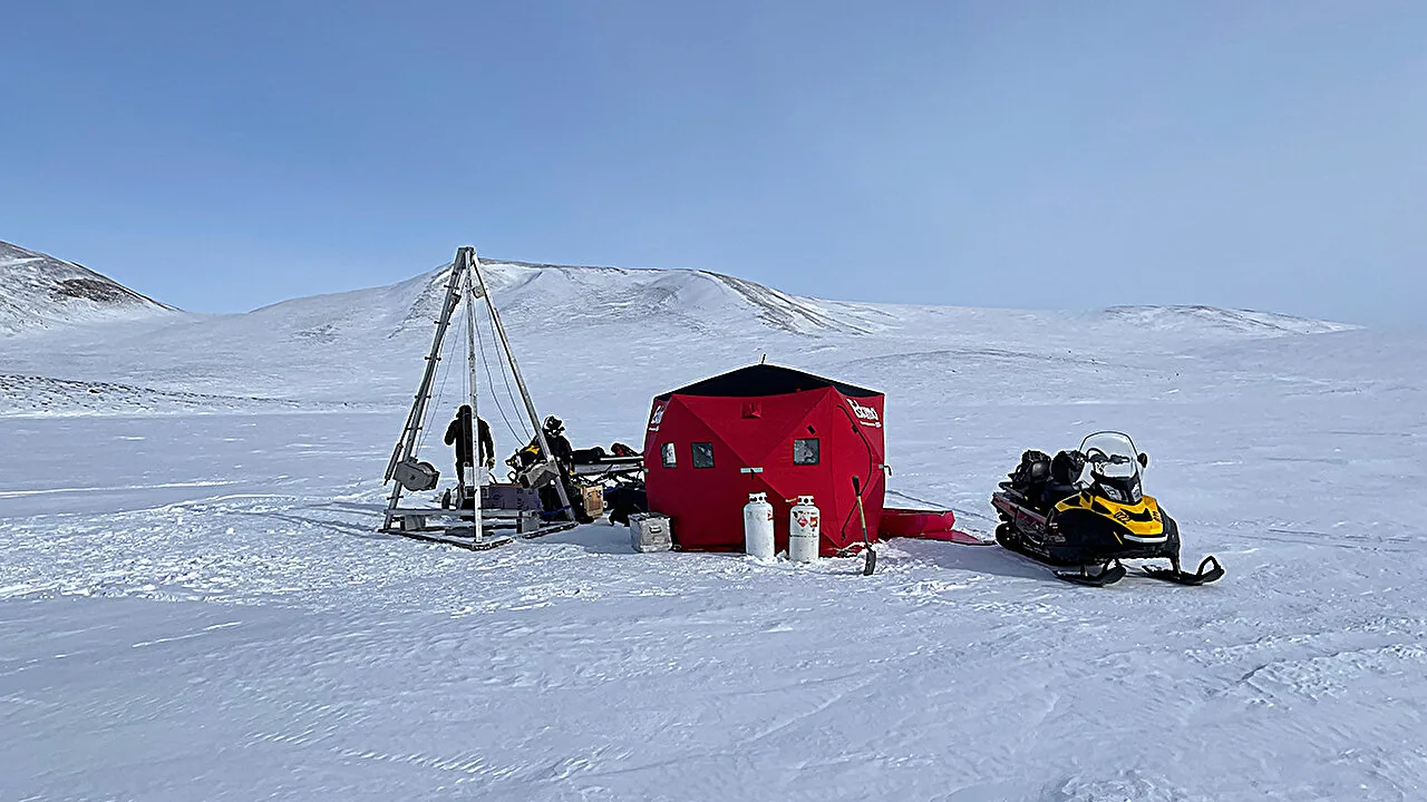
The lake sediment records showed clear differences in total sediment buildup between the two regions. Basins situated in discontinuous permafrost collected far more mineral soil than basins in continuous permafrost zones [1].


Diffusive Erosion Outpaces River Channel Transport
Geomorphologists separate two basic modes of soil movement in Arctic watersheds: diffusive processes and advective processes. Diffusive processes operate on hillslopes, transporting soil downward through slow soil creep, frost heave, and shallow thaw slumping. Advective processes occur along stream channels and rivers, where running water carves into bedrock and carries sediment downstream. Which force shapes subarctic terrain more strongly over geological time? Deciding which process shapes subarctic slopes has long divided geologists [1].
The research team used the lake sediment fluxes to constrain the diffusive and advective components of a numerical landscape evolution model. Their statistical analysis revealed that in both study regions, diffusive hillslope processes were statistically more significant than advective channel transport. Since the middle Holocene, slow downhill movement across valley flanks has been far more active in moving sediment than river cutting along central channels in both study areas [1]. Hillslope movement drove the system. Channel transport played a secondary role.

This finding challenges older modeling ideas that attributed most post-glacial landscape change to river incising. Instead, gentle hillslope transport sets the pace for sediment delivery to Arctic water bodies. Understanding this diffusive dominance matters because climate warming alters soil mechanics on hillsides far faster than it changes deep bedrock river channels [1].
Why Discontinuous Ground Triggers Higher Hillslope Erosion
The main distinction between the two study regions lay in the intensity of diffusive slope movement. In lake catchments underlain by discontinuous permafrost near Delta Junction, the average intensity of diffusive hillslope erosion was two to three times greater than in the continuous permafrost catchments near Toolik [1]. Where permafrost thawed into discontinuous patches, hillsides shed soil at much higher rates. The presence of unfrozen ground corridors speeds up seasonal soil movement down entire slopes.
Lead author Emrah Özpolat and his colleagues published their findings in the journal Earth’s Future, issue 14(9). Co-authors on the paper included E. Shelef, Mark Abbott, S. Mark, U. Mishra, N. Wondolowski, and B. P. Finney [1]. The researchers explained that continuous permafrost stabilizes hillsides by locking sediment in frozen ground, whereas discontinuous permafrost creates thawed corridors that allow groundwater to saturate soils and trigger frequent slope slumping.
The authors cautioned that local topography, soil makeup, and microclimates might influence specific erosion values at their study sites. Because conditions vary across the circum-Arctic, they advised that similar sediment core analyses should be conducted in other northern catchments to evaluate the wider geographic validity of their findings [1]. Despite these caveats, the two-to-threefold jump in hillslope erosion intensity shows how sensitive Arctic slopes are to ground thaw.
How Permafrost Degradation Alters Northern Watersheds
The Alaskan lake findings offer a clear warning for northern regions as climate change continues to warm high latitudes. Over coming decades, rising temperatures will shift extensive areas of continuous permafrost into fragmented, discontinuous zones. If the geomorphic patterns observed in subarctic Alaska hold elsewhere, this transition will double or triple the rate of hillslope erosion in warming polar watersheds during the coming century [3]. Solar Winds reported on CarbonCredit.io that faster erosion mobilizes deep soil carbon, potentially releasing greenhouse gases into the atmosphere.
Engineering geologist Greg Cocks shared the study results on LinkedIn, discussing practical engineering challenges that accompany permafrost degradation. Thawing hillslopes increase sediment supply to streams, degrading freshwater quality and disrupting fish habitats in subarctic river networks [4]. Soil instability also complicates civil planning, threatening roads, building foundations, and fuel pipelines constructed over formerly solid frozen ground. As slopes slump, repair costs rise for northern communities.
To manage these growing environmental risks, scientists and civil planners need landscape evolution models calibrated with empirical field data. The sediment core records from Toolik Lake and Delta Junction provide the concrete measurements needed to upgrade Arctic climate forecasts. Incorporating these direct lake core measurements into hazard mapping will help engineers and Indigenous communities protect roads and buildings against accelerating hillslope erosion as northern permafrost continues to thaw [4].
- ACADEMIC JOURNAL Özpolat, E., Shelef, E., Abbott, M., Mark, S., Mishra, U., Wondolowski, N., & Finney, B. P. (2026). Enhanced Erosion Across a Transition From Continuous to Discontinuous Permafrost in Alaska. Earth’s Future, 14(9). [Article Link]
- ONLINE NEWS Dzombak, R. (2026, October 14). Patchier permafrost is linked to more intense hillslope erosion in Alaska. Phys.org. [Article Link]
- WEBSITE Solar Winds. (2026, October 14). Discontinuous Permafrost Linked to 2-3x Higher Hillslope Erosion, Alaska Lake Cores Show. CarbonCredit.io. [Article Link]
- WEBSITE Cocks, G. (2026, September 23). Enhanced Erosion Across A Transition From Continuous To Discontinuous Permafrost In Alaska. LinkedIn. [Article Link]
APA 7: TWs Editor. (2026, October 15). Patchier Permafrost Accelerates Alaskan Hillslope Erosion. PerEXP Teamworks. https://perexpteamworks.com/en/hillslope-erosion-patchier-alaska-permafrost/


