






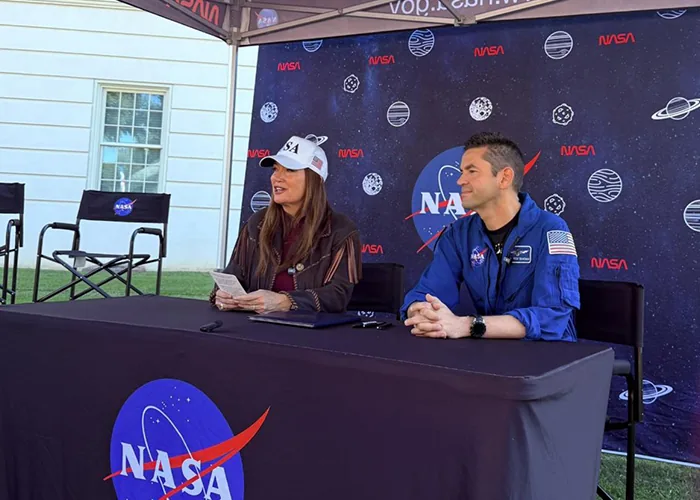
NASA and the U.S. Department of Agriculture (USDA) signed a memorandum of understanding on October 24, 2026, to combine space sensors with farm analytics. NASA Administrator Jared Isaacman and U.S. Secretary of Agriculture Brooke Rollins signed the pact at the University of Alabama in Tuscaloosa during NASA’s Inspiration Tour [1]. The new NASA USDA agreement connects orbital data streams with ground records to modernize crop assessments and hazard tracking in American farming communities [3]. By linking space sensors with local farm surveys, federal teams plan to give growers faster updates on water shortages and seasonal crop yields [7].
NASA USDA Agreement Sets Joint Science Priorities
The accord sets up a working relationship between civilian space teams and federal farm specialists. Under the NASA USDA agreement, federal teams will share research expertise in farm statistics, remote sensing science, crop models, and machine learning tools [1]. The signed charter takes effect immediately and runs for up to five years without forcing either agency to spend funds [7]. Staff at the University of Alabama in Tuscaloosa hosted the signing during NASA’s national Inspiration Tour [1].
Farm results come first. “NASA develops some of the most advanced sensing, computing, and analytical capabilities in the world, and we should put those tools to work wherever they can deliver meaningful outcomes for the American people,” said Isaacman during the signing event in Tuscaloosa. Staff from NASA Headquarters in Washington, including Camille Gallo and Elizabeth Shaw, noted that orbital instruments must feed directly into weekly USDA crop progress reports. Both teams want to run high-performance models over huge satellite data archives without costly delays [1]. Any future project requiring joint funding, assigned staff, or federal property will rely on separate binding pacts [7].
Modernizing Federal Agricultural Statistics
The joint accord directly backs the USDA Data Modernization Plan that Rollins introduced in September 2026 to overhaul farm statistics. Rollins designed the reform to tackle a steady decline in voluntary survey responses from farmers. Many growers also voiced concerns about the long hours needed to fill out complex federal questionnaires [7].
To address these survey hurdles, the department structured its reform around four central goals: simplifying data collection, refining field yield projections, connecting software systems, and sharing clearer information with growers [7]. Reliable data guides planting choices. “American farmers are the best in the world and deserve any solution we can leverage, even when it is out of this world,” said Rollins [1]. Pixel size dropped significantly. Under the leadership of Rollins, the USDA sharpened the spatial resolution of its signature Cropland Data Layer from 30 meters down to 10 meters, enabling analysts to identify individual crop plots and evaluate soil trends across varying county terrains [7]. Field teams will check these maps against ground reports [8].
Satellite Remote Sensing for Farm Operations
Space instruments provide regular views of soil moisture, surface heat, and plant vigor across millions of crop acres. NASA Earth Science and the NASA Acres research group already produce remote sensing feeds that track plant health during the growing season [7]. Orbital sensors monitor moisture drops and drought patterns that threaten key grain fields [1].
Similar airborne sensors have tracked environmental dynamics, matching earlier research flights tracking agricultural emissions in rural farm counties. Infrared sensors spot water stress days before leaves turn yellow [1]. While field teams check local soil cores, orbital tools track canopy heat to assess harvest outlooks, connecting with wider methods in crop health monitoring across diverse growing zones. When severe storms or long dry spells hit farm counties, quick satellite maps allow administrators to verify losses without waiting for slow field visits [7]. Fast damage verification helps USDA staff deliver disaster relief funds to ranchers and farmers when bad weather strikes [8].

How the NASA USDA Agreement Builds on Earlier Missions
NASA and the USDA share a long history of joint research on Earth science problems. In December 2020, NASA Administrator Jim Bridenstine and Agriculture Secretary Sonny Perdue signed a formal charter to apply space assets to American farming. That earlier framework addressed research priorities identified in the 2017 National Academies’ Earth Science Decadal Survey, supported by NASA officials Matthew Rydin and Sean Potter [2].
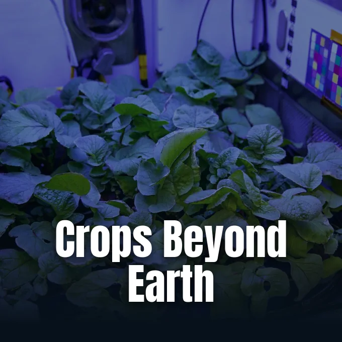
Bridenstine said microgravity research on the International Space Station could transform farm practices on Earth [2]. Fresh momentum came in December 2025, when President Donald Trump issued Executive Order 14369, titled Ensuring American Space Superiority. The directive instructed NASA to return American astronauts to the Moon by 2028 and build early elements of a permanent lunar outpost by 2030 [7]. Lunar crews need fresh food. To sustain long missions, researchers plan to adapt space-tested closed-loop plant systems and crop sensors for American farms while building lunar outposts [2]. That work fed directly into the accord signed in Tuscaloosa [3]. Open data policies mirror principles seen in open science frameworks under the Artemis Accords. By linking space goals with field agriculture, both teams can test automated tools that benefit growers on Earth and astronauts in space [2].
Cloud Systems and Algorithm Reviews
Handling huge Earth observation archives requires shared cloud tools. The interagency agreement establishes regular technical exchanges between USDA analysts and NASA Earth science teams in Washington. Software teams will assess cloud-native file formats, automated application programming interfaces (APIs), and scalable cloud storage built for massive observation files [7].
Cloud workflows let USDA analysts pull space feeds without building new server rooms [8]. Can mathematical models reliably separate crop stress from normal seasonal variation? Scientists will hold joint reviews of computer formulas that estimate crop health, planted acreage, and harvest yields [7]. Teams focus on correcting sensor bias, measuring mathematical uncertainty, and comparing predictions with ground truth data collected by county observers. Matching orbital readings with field tests keeps crop forecasts reliable when erratic weather alters normal growing cycles [8].
Long-Term Research Priorities
Beyond routine acreage tallies, federal scientists are studying how artificial intelligence can sharpen crop forecasts. The partnership explores machine learning tools and geospatial data systems to model plant stress and food supply risks [1]. Similar civilian data efforts will take center stage at the Potomac Officers Club 2026 FedCiv Summit on Oct. 29, featuring Rick Miner, acting assistant CIO for satellites at NOAA, and David Hong, acting CIO and chief AI officer at HHS [7].
Joint research will test whether predictive algorithms can spot regional crop losses before supply drops raise food prices [7]. Classroom outreach forms another major part of the joint plan. NASA and the USDA work through the National Science and Technology Council’s Committee on STEM Education to draw young Americans into farming science and space engineering [2]. The latest NASA USDA agreement establishes a direct bridge between orbital science and rural farm management [1]. By putting space tools to work in rural counties, both agencies aim to ensure that national space investments deliver lasting benefits for American growers [3].
- PRESS RELEASE Dooren, J. M. (2026). NASA, USDA Sign Agreement Advancing Earth Science, Agriculture. NASA. [Article Link]
- PRESS RELEASE National Aeronautics and Space Administration. (2020). NASA, USDA Sign Agreement to Improve Agricultural, Earth Science Research. NASA. [Article Link]
- ONLINE NEWS Space and Defense Editorial Team. (2026). NASA and USDA sign agreement to expand Earth science and agriculture collaboration. Space and Defense. [Article Link]
- ONLINE NEWS PressBee. (2026). NASA, USDA Sign Agreement Advancing Earth Science, Agriculture. PressBee. [Article Link]
- ONLINE NEWS Mirage News. (2026). NASA, USDA Partner on Earth Science, Agriculture. Mirage News. [Article Link]
- ONLINE NEWS World News Network. (2026). NASA, USDA Sign Agreement Advancing Earth Science, Agriculture. World News. [Article Link]
- ONLINE NEWS Elliott, S. (2026). USDA, NASA Sign MOU on Earth Observation for Crop Data. Executive Gov. [Article Link]
- ONLINE NEWS The Herald-Whig. (2026). USDA and NASA sign pact to use satellite data in crop estimates. The Herald-Whig. [Article Link]
APA 7: PerEXP Teamworks. (2026, October 27). NASA and USDA Sign Agreement to Advance Earth Science. PerEXP Teamworks. https://perexpteamworks.com/en/nasa-usda-agreement-earth-science/


