




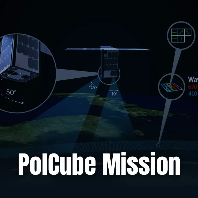
Can a shoebox-sized satellite untangle the complex interactions between airborne particles and Earth’s oceans? The PolCube mission addresses that challenge by deploying a compact polarimeter into orbit. Developed as a 12-unit (12U) CubeSat through an international collaboration between NASA’s Langley Research Center and the Korea Astronomy and Space Science Institute (KASI), the spacecraft monitors sunlight reflecting from our planet. The instrument measures both light intensity and polarization across a wavelength band spanning 410 to 864 nm. NASA scheduled the spacecraft for launch on November 3, 2025.
What Defines the PolCube Mission?
Nanosatellites have transformed modern orbital observation. PolCube adopts a 12-unit CubeSat configuration, combining modular electronic buses with a dedicated optical polarimeter developed through an international partnership between NASA’s Langley Research Center and the Korea Astronomy and Space Science Institute (KASI). Miniaturization demands severe volume discipline. By housing sensors, communications, and orientation controls inside twelve standardized cubic increments, the platform demonstrates how specialized climate research can operate within tightly constrained hardware boundaries. [1]
NASA established a targeted launch date of November 3, 2025, for the spacecraft. The core scientific objective focuses on characterizing atmospheric particles (microscopic liquid droplets and solid aerosols suspended in the air) and ocean properties across marine ecosystems. Traditional single-pixel orbital sensors struggle to isolate airborne haze from the underlying surface radiance of the sea. By observing how incoming solar illumination scatters across the air-sea interface, the spacecraft provides critical empirical measurements to improve global atmospheric modeling. [1]
While orbital laboratories study human physiology through astronaut monitoring aboard the International Space Station, autonomous nanosatellites address planetary physics without crew intervention. CubeSats execute automated observational routines programmed directly into their guidance computers. The PolCube mission demonstrates that compact secondary payloads can deliver targeted environmental surveillance. Flight readiness requires rigorous thermal vacuum testing.
How Polarimetry Analyzes Reflected Sunlight
Conventional satellite radiometers capture only light intensity (the total scalar brightness of incoming electromagnetic waves) without recording the orientation of those waves. In contrast, polarimeters record the geometric oscillation vector of the electric field as solar radiation interacts with matter. Unpolarized sunlight becomes partially polarized when it encounters gas molecules, aerosol particles, or the ocean surface. Light waves oscillate in specific geometric planes. Measuring both the degree and angle of polarization reveals the physical structure of the scattering particles. [1]
Why does this physical distinction matter so fundamentally for climate observation? When direct sunlight strikes the upper boundary of Earth’s atmosphere, it travels as unpolarized radiation with randomly aligned electric field vectors, but as soon as photons strike microscopic obstacles, their scattering directions dictate a preferential vibrational alignment. Ordinary radiometric imagers record only how many photons bounce back into orbit, leaving scientists to guess whether a bright signal reflects thin high-altitude cirrus clouds, dense mineral dust, or bright ocean sun glint. PolCube circumvents that ambiguity by recording polarization states together with absolute radiance. By calculating Stokes parameters (mathematical quantities representing the total intensity, degree of linear polarization, and orientation angle of polarized electromagnetic waves), the polarimeter isolates particle microphysics from background brightness variations. [1, 2]
Polarization data clarifies optical ambiguities. Reflected waves carry structural fingerprints. By capturing these subtle wave orientations, researchers decode particle distributions directly from orbit.
Why Multiple Observation Angles Matter
Observing a single atmospheric column from multiple viewing perspectives provides structural depth that nadir (straight-down looking) instruments cannot replicate. When sunlight scatters through a volume of air, the angular scattering function changes dramatically depending on whether the particles are spherical water droplets or jagged mineral grains. Viewing geometry dictates observable scattering peaks. By sweeping across multiple viewing angles as the satellite travels along its orbital trajectory, PolCube records how the intensity and polarization of reflected sunlight shift continuously. [1, 2]
Separating the atmospheric aerosol contribution from the underlying aquatic surface presents one of Earth science’s steepest technical hurdles. Ocean surfaces act like variable mirrors, producing intense direct sun glint that can easily swamp delicate atmospheric signals. Multi-angle polarimetry circumvents this obstacle because surface-reflected specular glint polarizes according to Fresnel reflection laws at predictable angles, whereas atmospheric particles scatter light into distinct angular lobes. Algorithms can filter out the polarized ocean reflections. This mathematical separation enables scientists to retrieve true aerosol optical depth and particle size distributions over coastal and open-ocean waters. [1]
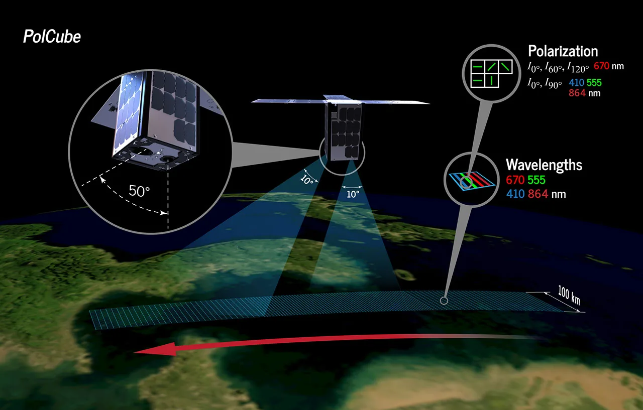
The official NASA mission diagram illustrates this multi-angle principle, showing incident sunlight reflecting off both atmospheric constituents and oceanic layers into the satellite’s polarimetric detectors. Angles shift continuously during flight. The spacecraft tracks reflected rays across changing geometric planes, turning raw angular flux into calibrated environmental profiles. Each angular pass adds another layer of observational certainty. [2]


Examining the 410 to 864 Nanometer Spectrum
Spectral coverage defines the sensitivity of any optical instrument. PolCube gathers data across a continuous spectral span ranging from 410 nanometers (in the violet-blue visible spectrum) to 864 nanometers (in the near-infrared boundary). This wavelength range corresponds to critical optical regimes in Earth’s atmosphere. At the short-wavelength boundary near 410 nm, Rayleigh scattering (molecular light dispersion proportional to the inverse fourth power of wavelength) dominates the atmospheric signal, offering intense sensitivity to fine smoke particles and urban smog. [1]
Moving toward longer wavelengths near 864 nm, molecular scattering subsides, allowing photons to penetrate deeper or highlight larger airborne constituents such as maritime sea spray and coarse windblown dust. Water absorption changes significantly across this spectrum. In the near-infrared band, pure water absorbs incoming sunlight almost completely, creating an exceptionally dark oceanic background. That dark aquatic background allows instruments to detect overlying aerosol plumes with minimal water-leaving interference, whereas visible blue channels capture subsurface backscattering from phytoplankton and suspended marine sediments. [1]
Combining multiple spectral channels across the 410–864 nm interval enables scientists to reconstruct the aerosol size distribution curve. Smaller particles scatter blue light far more effectively than infrared radiation, producing a steep spectral slope in measured polarization. Larger particles yield flatter spectral responses. By evaluating how polarization ratios vary between 410 nm and 864 nm, data processing pipelines can infer average particle radii without direct physical sampling. [1]
Who Leads the International Collaboration?
NASA’s Langley Research Center serves as the primary American institutional anchor for the mission. Located in Hampton, Virginia, Langley stands as NASA’s oldest field center, renowned historically for pioneering aeronautical research and advanced atmospheric science. Through decades of radiation budget studies and airborne lidar investigations, Langley engineers have developed world-leading expertise in aerosol remote sensing. In the PolCube partnership, Langley collaborates directly with the Korea Astronomy and Space Science Institute (KASI), the national research agency responsible for South Korea’s space science research. [1]
Scientific oversight rests under Program Scientist Snorre Stamnes, who coordinates mission science requirements and validation protocols for NASA. Jay Madigan documented the project’s baseline parameters in NASA Science’s official release, outlining how international cooperation bridges instrument fabrication and calibration. Such bilateral arrangements combine specialized hardware design with international scientific teams. Developing shared data algorithms between American and South Korean researchers ensures that downlinked telemetry translates efficiently into standardized science products. [1]
In parallel with large-scale deep space observatories, such as NASA’s Roman mission investigating Milky Way astrophysics, compact nanosatellites provide focused Earth observations at accessible development costs. Official programmatic updates remain accessible through NASA’s PolCube mission portal. In the PolCube mission, institutional partnerships distribute engineering risks while broadening access to orbital polarimetric data. Cooperative frameworks accelerate scientific return across participating research communities.
What Boundaries Constrain the Current Data?
NASA’s official release provides essential mission parameters while leaving specific operational details unannounced. The publication establishes the November 3, 2025, launch target, the 12U CubeSat chassis, and the 410–864 nm wavelength span, but it does not specify the launch provider, rocket vehicle, or deployment site. Orbital parameters remain publicly unconfirmed. Neither the planned orbital inclination nor the target altitude appears in the initial technical brief. These orbital factors will ultimately determine the satellite’s ground track, revisit frequency, and daily polarimetric coverage over oceanic basins. [1]
Similarly, NASA does not publish the anticipated operational lifetime or specific detector array dimensions for the polarimeter. Small CubeSat instruments frequently encounter thermal drift and radiation degradation in low Earth orbit, which can alter detector sensitivity over time. Maintaining on-orbit radiometric calibration across multi-angle lenses requires careful vicarious calibration against known desert or open-ocean targets. The released summary establishes the mission’s foundational architecture; full empirical verification will unfold once the spacecraft reaches orbit and transmits its first telemetry packets. [1]
Upcoming calibration phases and ground validation campaigns will determine how effectively the PolCube mission bridges small-satellite engineering with climate-grade observation. As launch preparations advance toward late 2025, researchers await detailed operational timetables and orbital deployment parameters from NASA and KASI. [1]
- WEBSITE Madigan, J. (2026, September 14). NASA Langley Research Center PolCube Mission Information Site. NASA Science. [Article Link]
- WEBSITE Marvel, T., & NASA. (2023, May 22). PolCube Polarimetry Diagram [Diagram]. NASA Science. [Article Link]
APA 7: TWs Editor. (2026, September 15). How the PolCube mission maps Earth’s atmosphere and oceans. PerEXP Teamworks.


1 comment