





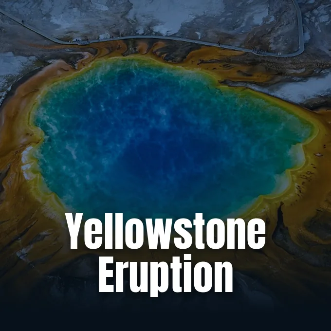
Could a catastrophic eruption awaken beneath northwestern Wyoming and reshape the modern world? The Yellowstone supervolcano last produced a full-scale super-eruption roughly 631,000 years ago, shattering ecosystems across hundreds of kilometers and spreading volcanic particles that cooled global temperatures. Disaster researchers Ilan Kelman of University College London and Matthew Blackett of Coventry University constructed a detailed thought experiment examining how contemporary infrastructure would confront an escalating crisis [2]. Their simulation tracks geological warning indicators from early micro-tremors to vast atmospheric plumes [1].
How Does a Yellowstone Supervolcano Swarm Begin?
A hypothetical Yellowstone supervolcano crisis begins when automated monitors detect an anomalous cluster of shallow micro-earthquakes beneath the caldera. At the University of Utah Seismograph Stations, an analyst notices sharp spikes interrupting baseline recordings shortly after 6 a.m. [2]. Overnight instruments reveal a tightening cluster of subtle tremors beneath the caldera, an oval depression spanning roughly 55 to 70 kilometers (34 to 43 miles) across northwestern Wyoming [1]. While thousands of benign earthquakes occur annually throughout the national park, repeating seismic events documented by geophysicists show that continuous upward migration distinguishes developing volcanic unrest from background tectonic settling [4].
Seismologists quickly notify partner institutions in the Yellowstone Volcano Observatory to verify whether hydrothermal fluids or fresh magma drive the localized tremors [1].
While past geological studies, such as research on how a devastating volcanic eruption preserved clues to Andes uplift, reconstruct prehistoric events through ancient ash deposits, this modern scenario examines immediate societal vulnerability across computerized power and transport networks. Specialists deployed across the monitoring network rely on dense arrays of seismometers, GPS receivers, and borehole strainmeters to monitor crustal deformation in real time. Instruments track subtle ground shifts [1]. Disaster researchers Kelman and Blackett framed this predictive scenario as an exploration of the ‘worst-case scenario’ to evaluate how interconnected civilian systems respond under severe geological pressure [2]. Scientists monitor earthquake depth, frequency, and migration velocity, because ascending magma fractures brittle regional rock layers and pushes pressurized hydrothermal fluids through opening structural faults [4].
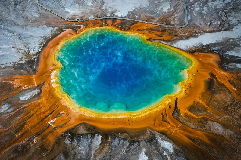
Magma Ascent Signals Beneath the Caldera
One month into the scenario, upward migration accelerates as satellite radar reveals widespread ground deformation expanding across the central plateau. Automated GPS stations positioned directly above the migrating earthquake swarm drift apart by several centimeters, confirming that intense magma-driven pressure is steadily flexing the overlying continental crust [4]. Field teams measure heightened subsurface strain while observing that new micro-seismic events align along a narrow structural fracture zone beneath the caldera floor [2]. These geophysical anomalies match pre-eruptive ground movements observed in volcanic systems such as Hawai’i, where ascending molten basalt forces its way toward the surface [1].
Historical precedents demonstrate that Yellowstone frequently produces significant ground deformation without culminating in an explosive eruption. Between 2013 and 2014, parts of the caldera rose at rates exceeding 15 centimeters annually, accompanied by sustained seismicity that culminated in a magnitude 4.8 earthquake, the strongest recorded in the national park since 1975 [1]. Research by geophysicist Charles Wicks confirmed that Norris Geyser Basin uplift reversed into subsidence (downward ground movement) as deep hydrothermal fluids redistributed through subsurface faults rather than fresh magma breaching the upper crust. Uplift does not guarantee an explosion [5].
As localized tremors intensify, probabilistic modeling indicates that the likelihood of a major cataclysm within three months climbs from 6 to 9 percent, eventually reaching 21 to 27 percent [2]. Officials at the Federal Emergency Management Agency begin preliminary logistical planning for large-scale evacuations while avoiding premature public alarm [1]. The Yellowstone Volcano Observatory officially raises the Volcano Alert Level from normal to advisory, signaling that ongoing unrest has breached established baseline thresholds [2].

Evacuation Protocol for a Yellowstone Eruption
Two weeks before the projected crisis, escalating seismic data compel scientists to revise the eruption probability upward to between 85 and 92 percent within three weeks [1]. The Yellowstone Volcano Observatory elevates its formal warning status to watch, while the U.S. Geological Survey officially changes the international Aviation Colour Codes across regional airspace to orange [2]. Civil aviation authorities immediately reroute commercial passenger flights around regional corridors to safeguard jet engines from abrasive airborne particles [1].
Emergency authorities designate an expansive exclusion zone extending 100 kilometers (62 miles) beyond the boundaries of Yellowstone National Park [1]. This mandatory directive impacts roughly 200,000 permanent residents and thousands of seasonal visitors traveling through the mountainous corridor [2]. During a high-stakes briefing, public discourse crystallizes around the urgent warning: ‘It’s gonna blow!’. Two hundred thousand residents must evacuate [1].
Global geopolitical dynamics would determine whether neighboring nations offer comprehensive humanitarian assistance to displaced communities or implement strict international border closures reminiscent of historic pandemic travel restrictions [2]. Affluent individuals might self-evacuate using dual passports and private resources, whereas marginalized communities face severe transit constraints on overcrowded rail networks and buses [1]. In their disaster framework, Kelman and Blackett note that managing hundreds of thousands of displaced people demands sustained supplies of food, clean drinking water, temporary housing, and electrical infrastructure across regional borders [2].


Why Hydrothermal Steam Blasts Precede Magma Venting
The opening phase of a Yellowstone supervolcano eruption does not begin with an instantaneous rupture of the entire magma chamber [1]. Instead, ascending magma first penetrates shallow hydrothermal reservoirs, rapidly heating trapped groundwater past its boiling point [2]. At atmospheric pressure, superheated water expands roughly 1,700 times in volume as it flashes into steam [1]. This sudden volumetric expansion generates violent phreatomagmatic blasts, shattering surface caprock formations and hurtling superheated hydrothermal mud, mineral debris, and fractured boulders several kilometers into the upper air [2].
Thermal features across Yellowstone hydrothermal areas routinely exhibit delicate pressure balances between boiling subterranean water and surrounding mineral conduits [1]. In the final fortnight before eruption, field sensors record irregular venting cycles and geochemical shifts, including elevated emissions of carbon dioxide and sulfurous gases into surrounding thermal springs [2]. Even the famous Old Faithful geyser loses its regular eruptive timing as deep volcanic tremors force open new ground fissures. Old Faithful loses its predictable rhythm [1].
Within an initial radius of 4 to 6 kilometers (2.5 to 3.7 miles) from the eruptive centers, falling rocks, scalding mud, and high-velocity debris batter the landscape [1]. Established exclusion zones spare human lives, but surrounding wildlife, grazing livestock, and dense pine forests suffer immediate destruction [2]. Beyond the perimeter, onlookers observe an impressive 2-kilometer-high (1.2-mile-high) steam plume rising above the trees before deeper magmatic conduits fracture open [1].
Can the Yellowstone Supervolcano Ash Reach Denver?
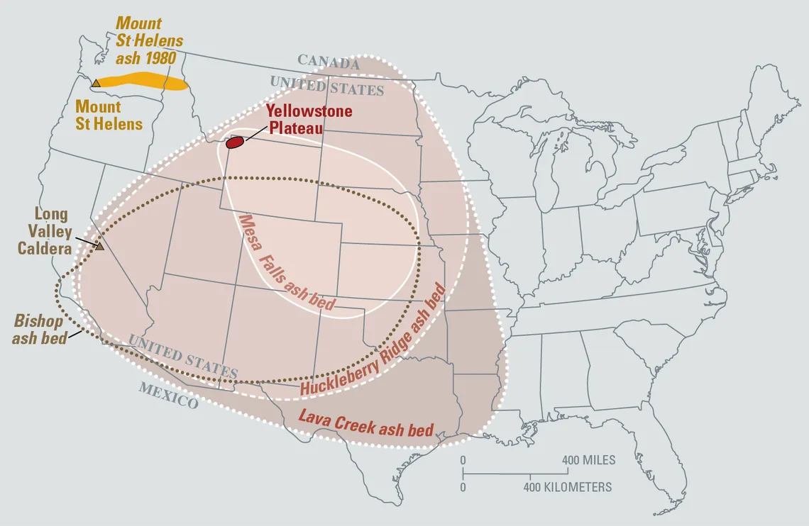
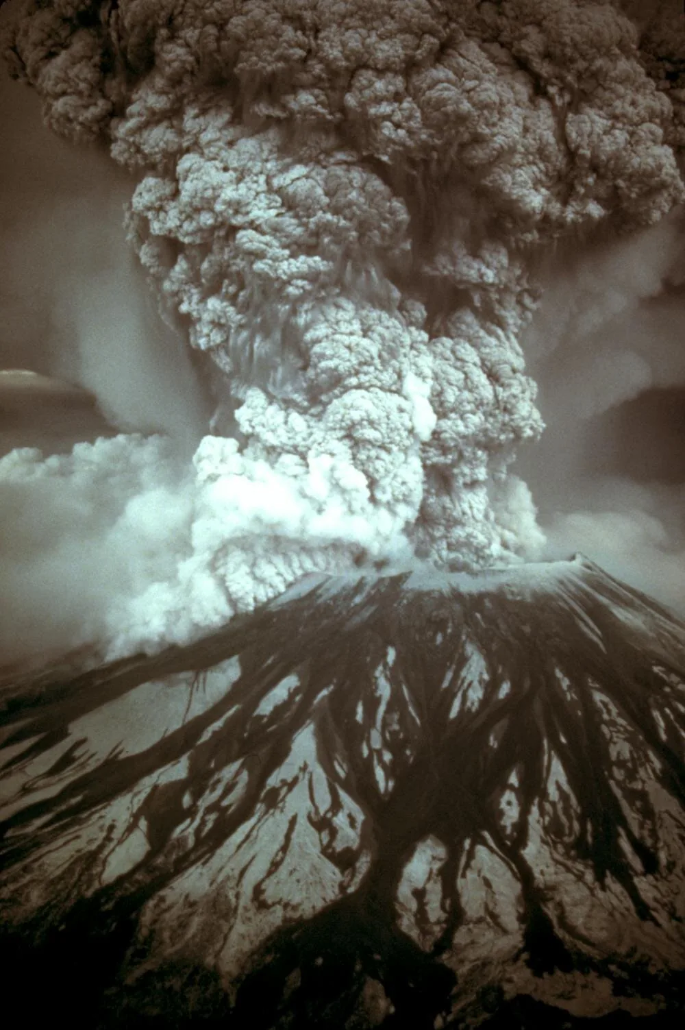
Fine ash particles from a full-scale Yellowstone supervolcano eruption would reach Denver within hours as high-altitude winds disperse the expanding tephra cloud [1]. Following initial hydrothermal venting, gas-saturated magma heated between 650 and 800°C (1,200 to 1,500°F)—temperatures well above the melting points of lead and zinc—violently breaches the shattered surface [2]. As confining geological pressure drops precipitously, dissolved volatile gases separate from the silicate melt and expand catastrophically, shredding magma into porous pumice and microscopic glass shards [1]. Intense thermal buoyancy drives this pulverized material upward, creating an immense eruption column that surges 30 to 50 kilometers (19 to 31 miles) into the stratosphere [2].
Denver sits 800 kilometers away. On a clear morning, the upper umbrella cloud of this monumental convective plume would remain visible from Denver, located roughly 800 kilometers (500 miles) to the southeast [1]. Landmark computer simulations by USGS researchers Larry Mastin, Alexa Van Eaton, and Jacob Lowenstern demonstrate that a VEI 8 super-eruption produces a massive umbrella cloud that expands radially in a bull’s eye pattern, pushing volcanic ash more than 1,500 kilometers upwind regardless of prevailing atmospheric wind currents [3]. The expanding convective column easily penetrates far beyond standard cruising altitudes of commercial passenger aircraft, which typically fly at heights up to approximately 13 kilometers (8 miles) [2].
Airborne glass shards and acidic aerosols present severe hazards to aviation engines, scouring cockpit windshields and melting inside hot turbine combustion chambers [2]. Ground monitoring stations across neighboring states would record plummeting air quality and widespread daylight blackout as dense tephra blankets the intermountain West [1]. The U.S. Geological Survey and the Yellowstone Volcano Observatory advance their emergency status to red under international Aviation Colour Codes as catastrophic ash fall spreads across continental transport corridors [2].
Atmospheric Fallout and Global Climate Consequences
The global consequences of a sustained VEI 8 super-eruption stem from the vast volume of fine tephra and sulfur aerosols injected directly into the stratosphere [1]. Simulations by the USGS Cascades Volcano Observatory reveal that ash accumulation would reach decimeters to meters in the northern Rocky Mountains, with Billings, Montana receiving nearly three feet of dense ashfall. Even thousands of kilometers away, millimeters to centimeters of abrasive glass dust would settle across the East, West, and Gulf Coasts [3]. Once circulating aloft, microscopic volcanic sulfate aerosols reflect incoming solar radiation, generating prolonged planetary cooling that disrupts regional weather systems for multiple agricultural seasons [1].
Surface infrastructure across North America would experience compounding failures, as accumulated ash collapses residential roofs, contaminates municipal water reservoirs, and short-circuits critical high-voltage electrical transformers across regional power grids [1]. Agricultural heartlands beneath the fallout plume face catastrophic crop destruction, while continental transportation networks stall from obstructed roads and closed rail hubs [2]. Disrupted global food supplies could cause severe international economic recessions and hospital strain, with disaster models projecting between 0.7 and 1.3 billion premature casualties worldwide during the ensuing decade of agricultural disruption [1].
Yellowstone is not overdue for eruption [1]. USGS monitoring records show that the caldera has remained eruption-free for 70,000 years, and the probability of another cataclysmic event in the coming centuries remains exceedingly low [3]. The detailed scenario constructed by Kelman and Blackett demonstrates that human survival during extreme natural hazards depends fundamentally on international communication, civic preparation, and resilient emergency logistics [2]. Rather than assuming inevitable civilizational collapse, understanding the step-by-step physical progression of a potential Yellowstone supervolcano event enables geological agencies to refine early detection protocols and fortify critical infrastructure against extreme geological disruption [1].
- ONLINE NEWS Kelman, I., & Blackett, M. (2026). Blow-by-blow account of what would happen if the Yellowstone supervolcano erupted now. Knowridge Science Report. [Article Link]
- ONLINE NEWS Kelman, I., & Blackett, M. (2026). A blow-by-blow account of what would happen if the Yellowstone supervolcano erupted now. Nautilus. [Article Link]
- ACADEMIC JOURNAL Mastin, L. G., Van Eaton, A. R., & Lowenstern, J. B. (2014). Modeling ash fall distribution from a Yellowstone supereruption. Geochemistry, Geophysics, Geosystems, 15(8), 3459-3475. [Article Link]
- ACADEMIC JOURNAL Massin, F., Farrell, J., & Smith, R. B. (2013). Repeating earthquakes in the Yellowstone volcanic field: Implications for rupture dynamics, ground deformation, and migration in earthquake swarms. Journal of Volcanology and Geothermal Research, 257, 159-173. [Article Link]
- ACADEMIC JOURNAL Wicks, C. W., Dzurisin, D., Lowenstern, J. B., & Svarc, J. (2020). Magma Intrusion and Volatile Ascent Beneath Norris Geyser Basin, Yellowstone National Park. Journal of Geophysical Research: Solid Earth, 125(2). [Article Link]
APA 7: PerEXP Teamworks. (2026). What Happens if the Yellowstone Supervolcano Erupts? PerEXP Teamworks.


