





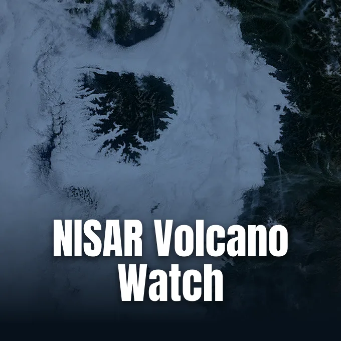
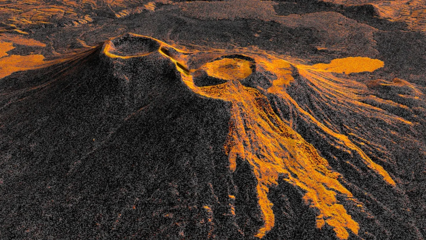
Can the US-India satellite NISAR transform how geophysicists track volcanic eruptions that remained dormant for nearly five centuries? Operating from an orbital altitude of 464 miles (747 kilometers), the NASA-ISRO Synthetic Aperture Radar observatory delivered an unprecedented answer by recording a continuous time-lapse sequence of Russia’s remote Krasheninnikov volcano. An 8.8-magnitude earthquake in the nearby Pacific Ocean awakened the northern crater in July 2025, initiating the mountain’s first documented molten discharge since approximately the year 1550. Seventeen radar passes assembled through mid-August revealed active lava filling an inner caldera before spilling eastward across the Siberian wilderness [1].
- Awakening Krasheninnikov After Five Centuries of Slumber
- How the US-India Satellite NISAR Maps Volcanic Terrain
- Why Did India Launch US Satellite Technology?
- How US-India Satellite Radar Penetrates Changing Landscapes
- What Is India’s Satellite Role in Planetary Radar Observation?
- Disaster Response Insights from the India-US Joint Satellite
Awakening Krasheninnikov After Five Centuries of Slumber
The volcano had slept since 1550. An 8.8-magnitude ocean earthquake struck the Pacific coast on July 30, 2025, jolting the northern cone into violent eruptive renewal [1].
Located along the eastern coast of Russia’s Kamchatka Peninsula, Krasheninnikov consists of a volcanic pair situated within a complex caldera basin. While dozens of active Kamchatka volcanoes undergo routine ground-based surveillance due to repeated historical outbursts, Krasheninnikov remained largely uninstrumented because human observers had not recorded eruptive activity there for nearly five hundred years. When seismic shaking destabilized the dormant volcanic plumbing, molten rock breached the northern summit cone. While geophysicists evaluating structural collapses previously studied subsurface movements when comparing the magma chambers under the Hunga volcano before and after its 2022 eruption, Krasheninnikov offers a distinct opportunity to document subaerial lava effusion across pristine terrain [1].
Initial surface venting generated a steady, eastward-traveling flow of lava and fragmented volcanic debris that gradually spilled beyond the primary crater rim. Satellite imagery confirmed that another distinct lobe had escaped toward the northwest, likely erupting shortly after the initial seismic jolt before orbital sensors commenced standardized operations. Ground stations in Kamchatka lack dense physical sensor arrays near this remote peak, leaving satellite observations as the sole mechanism for tracking landscape modification [2].
How the US-India Satellite NISAR Maps Volcanic Terrain
Synthetic aperture radar operates by broadcasting thousands of high-frequency microwave pulses toward the planet each second and recording the scattered signals that return to space. Managed by Caltech for NASA, the Jet Propulsion Laboratory in Southern California pioneered this imaging technique to observe dynamic planetary surfaces without relying on daylight illumination. From an orbital height of 464 miles (747 kilometers), the US-India satellite NISAR passes over the same coordinates twice every twelve days, collecting data along both south-to-north ascending tracks and north-to-south descending passes [1].
Mathematical processing combines multiple microwave reflections collected as the satellite travels along its orbital trajectory, synthesizing an antenna aperture significantly larger than the physical spacecraft structure. This computational sharpening yields exceptional geometric clarity across rugged topography. Each individual pixel in the processed Krasheninnikov time-lapse represents a surface patch measuring approximately 30 feet by 30 feet (10 meters by 10 meters), an area roughly half the footprint of a regulation tennis court. Because molten rock exhibits distinct dielectric properties and surface roughness, fresh lava reflects microwave energy far more intensely than the surrounding snowy slopes or barren volcanic scree. Consequently, active flows appear distinctly luminous in the resulting radar imagery, allowing geophysicists to differentiate molten boundaries from static rock faces [1].

Each pixel spans ten meters. This spatial fidelity allowed researchers to sequence seventeen individual radar acquisitions collected between December 25, 2025, and mid-August into a continuous time-lapse animation. The resulting visual record documents molten rock filling a minor inner caldera before overtopping the primary rim and fanning outward across the Siberian wilderness [4].
Why Did India Launch US Satellite Technology?
India partnered with the United States to deploy NISAR because combining complementary radar bands on a single orbital platform provides unprecedented multi-frequency observation of Earth’s dynamic systems. Rather than operating isolated national missions, NASA and the Indian Space Research Organisation (ISRO) pooled advanced aerospace resources to establish an open-access planetary monitoring observatory. The joint initiative distributes technical responsibilities across both space agencies, pairing American expertise in long-wavelength radar with Indian satellite bus engineering and S-band radar instrumentation [4].
Under the bilateral architecture, ISRO engineered the primary spacecraft bus, supplied the launch integration, and developed the high-frequency S-band synthetic aperture radar. Caltech’s Jet Propulsion Laboratory constructed the longer-wave L-band radar system and delivered the mission’s largest radar antenna reflector. Measuring 39 feet (12 meters) in diameter, this drum-shaped wire-mesh structure represents the largest radar antenna reflector NASA has ever deployed into space. The giant reflector focuses dual-frequency microwave beams onto the terrestrial surface, capturing simultaneous data swaths that neither nation could harvest alone [1].
ISRO provided the spacecraft bus. This international division of labor also democratizes planetary science by routing raw data through open computing archives. While NASA routes L-band products through the Alaska Satellite Facility Distributed Active Archive Center in Fairbanks, ISRO oversees regional telemetry and distribution, ensuring scientists across developing nations obtain high-resolution radar datasets without licensing restrictions [1].


How US-India Satellite Radar Penetrates Changing Landscapes
Operating dual radar frequencies on a single free-flying spacecraft represents a historic milestone in satellite remote sensing. The US-India satellite deploys its longer-wavelength L-band system to penetrate dense forest canopies and reveal underlying ground deformation, while the shorter-wavelength S-band system reflects off upper foliage to gauge vegetative biomass and canopy structure. This dual-frequency capability ensures that terrestrial changes remain measurable regardless of dense vegetation, persistent cloud cover, or heavy seasonal precipitation [1].
Matthew Pritchard, a member of the NISAR science team and geophysicist at Cornell University who analyzed the Krasheninnikov animation, underscored the transformative nature of these orbital sensors. Pritchard completed doctoral research on Kamchatka volcanoes more than twenty years ago, when satellite radar data was scarce, orbital revisit cycles spanned months, and image resolution remained coarse. Today, NISAR provides systematic coverage of virtually all 1,300 active, above-sea-level volcanoes across the globe. As Pritchard explained: “The consistency is crucial. Twice every 12 days, acquiring in this high-resolution mode and in two observation directions, this shows the promise of NISAR to closely monitor natural hazards” [1].
Microwave pulses easily pierce dense Pacific fog banks and volcanic plumes that routinely obscure optical satellites over the Kamchatka Peninsula. Furthermore, synthetic aperture radar functions identically during total Arctic darkness, acquiring unobstructed surface measurements through Siberian winter nights [2].
What Is India’s Satellite Role in Planetary Radar Observation?
India’s primary satellite role centers on operating the spacecraft bus, directing orbit-maintenance maneuvers, and managing the high-resolution S-band radar payload throughout the mission lifetime. ISRO mission controllers maintain orbital positioning from command facilities in Bengaluru, coordinating complex orbital adjustments to keep NISAR aligned within its tight twelve-day repeating flight corridor. This precise station-keeping guarantees that radar interferometry can detect subtle crustal swelling or subsidence measuring mere fractions of an inch [1].
Beyond navigational operations, ISRO scientists utilize S-band observations to monitor coastal geomorphology, agricultural soil moisture, and crustal deformation throughout South Asia and the Indian Ocean rim. Similar investigations into subterranean magma dynamics also feature in the Socorro magma body studies, illustrating how geophysical monitoring clarifies subterranean magma plumbing. In Kamchatka, the combined radar capabilities confirm how tectonic stresses awaken dormant volcanic systems [3].
Pritchard analyzed the sequential radar frames. Summarizing the wider scientific horizon enabled by the orbital platform, Pritchard observed: “We’re seeing volcanoes around the world that we’ve never really had eyes on like this before.” For centuries, volcanic summits located across polar or sub-polar latitudes erupted without scientific witness, but systematic orbital scanning ensures that unmonitored eruptions no longer escape detection [1].
Disaster Response Insights from the India-US Joint Satellite
Tracking the Krasheninnikov eruption demonstrates how the India-US joint satellite platform can transform emergency response and civil hazard management. Beyond mapping molten flows in remote wilderness, synthetic aperture radar provides vital situational intelligence following catastrophic earthquakes, destructive landslides, and coastal flooding events. Disaster management agencies can contrast pre-disaster baseline passes with post-event radar snapshots to identify collapsed infrastructure, delineate flooded communities, and pinpoint ground rupture zones even when storms ground aerial reconnaissance flights [4].
Molten rock reflects microwaves brightly. By publishing L-band radar data products openly through the Alaska Satellite Facility Distributed Active Archive Center in Fairbanks, NASA and ISRO ensure that researchers, disaster coordinators, and local authorities worldwide inspect fresh observations within hours of downlink. As climate shifts accelerate glacier melt and destabilize steep volcanic slopes, consistent twelve-day radar revisits will provide critical early warning signals for vulnerable populations across the circum-Pacific Ring of Fire [1].
- PRESS RELEASE Carney, S., & NASA Jet Propulsion Laboratory. (2026, September 24). US-India Satellite Captures Time-lapse Video of Volcanic Eruption. NASA. [Article Link]
- ONLINE NEWS Mirage News. (2026, September 24). US-India Satellite Films Volcanic Eruption Time-lapse. Mirage News. [Article Link]
- ONLINE NEWS PressBee. (2026, September 24). US-India Satellite Captures Time-lapse Video of Volcanic Eruption. PressBee. [Article Link]
- WEBSITE Custommapposter. (2026, September 25). NASA-ISRO Satellite Captures Stunning Time-Lapse of Rare Volcanic Eruption in Russia (2026). Custommapposter. [Article Link]
APA 7: PerEXP Teamworks. (2026, September 25). US-India Satellite Captures Erupting Kamchatka Volcano. PerEXP Teamworks. https://perexpteamworks.com/en/us-india-satellite-kamchatka-volcano/


