





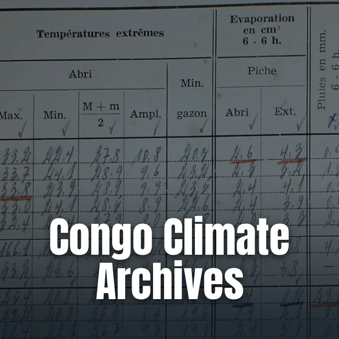
Centuries-old trees in the Congo Basin shade the second-largest tropical rainforest on the planet, but international climate assessments have long struggled to evaluate warming trends in Central Africa due to a lack of ground data [1]. While wealthy nations maintain automated monitoring networks, historical climate logs in the Democratic Republic of the Congo remained handwritten on paper and locked in provincial storage [3]. By recovering and digitizing thousands of these fragile documents, an international research team has now reconstructed the full trajectory of Congo Basin warming between 1908 and 2023. Their findings show that extreme heat events became twice as common from the 1960s to the 1980s, offering direct ground evidence of climate shifts across this tropical forest [1].
Rescue Work in the Yangambi Archive
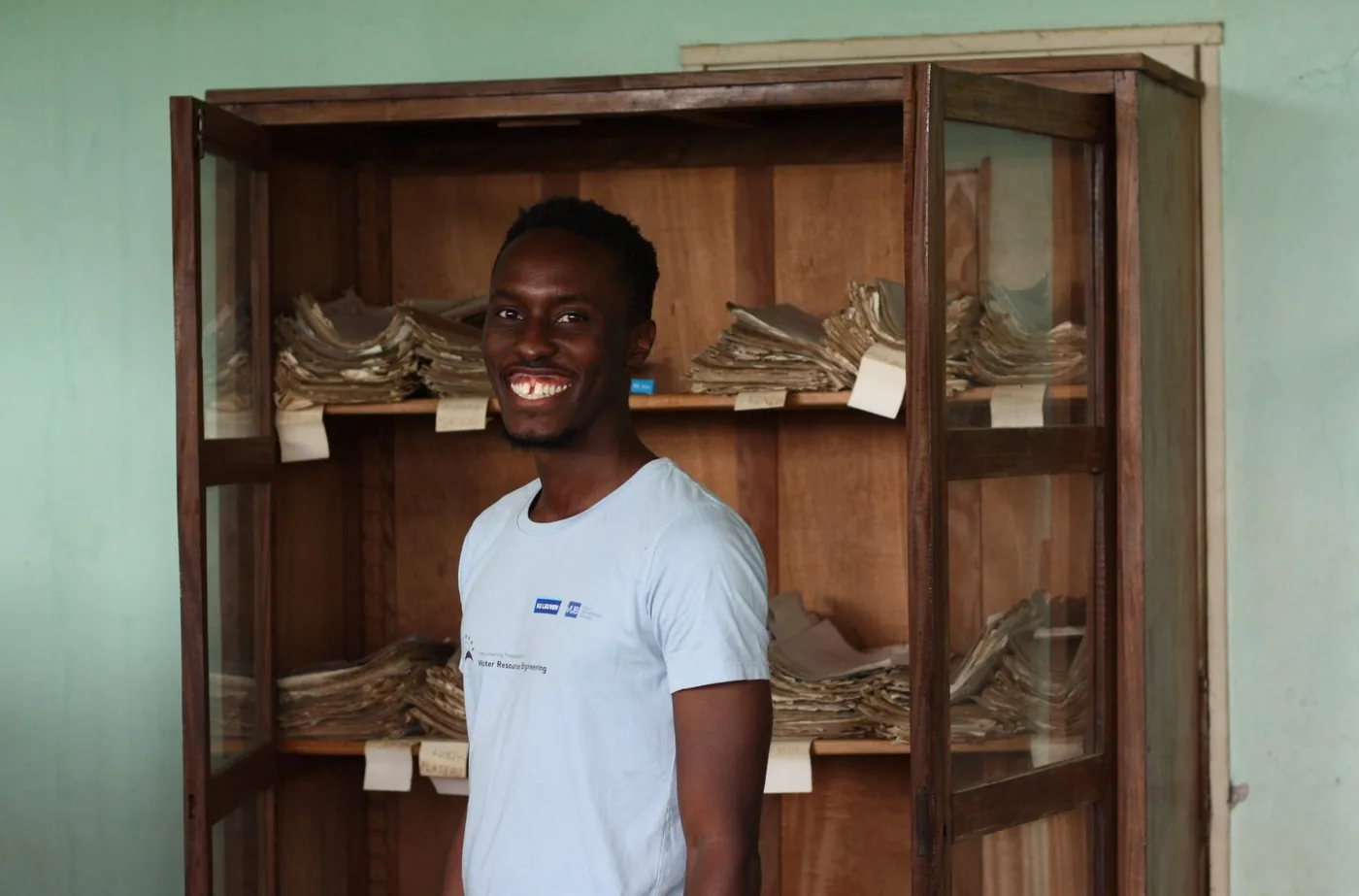
In collaboration with Congolese colleagues from Ghent University and Université de Kisangani, hydrologist Derrick Muheki, a doctoral researcher at Vrije Universiteit Brussel (VUB) who grew up in south-west Uganda near the Congolese border, visited Yangambi in 2023 for two field campaigns. Belgian colonial authorities developed Yangambi as an agricultural hub along the Congo River between 1908 and 1960, leaving behind research facilities that became the National Institute of Agronomic Studies and Research (INERA). The connecting roads are unpaved, making motorbikes the only dependable transport. Muheki rode on one bike while a second motorcycle carried his camera, lamps, and rechargeable batteries [3].
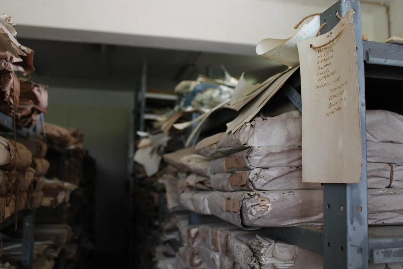
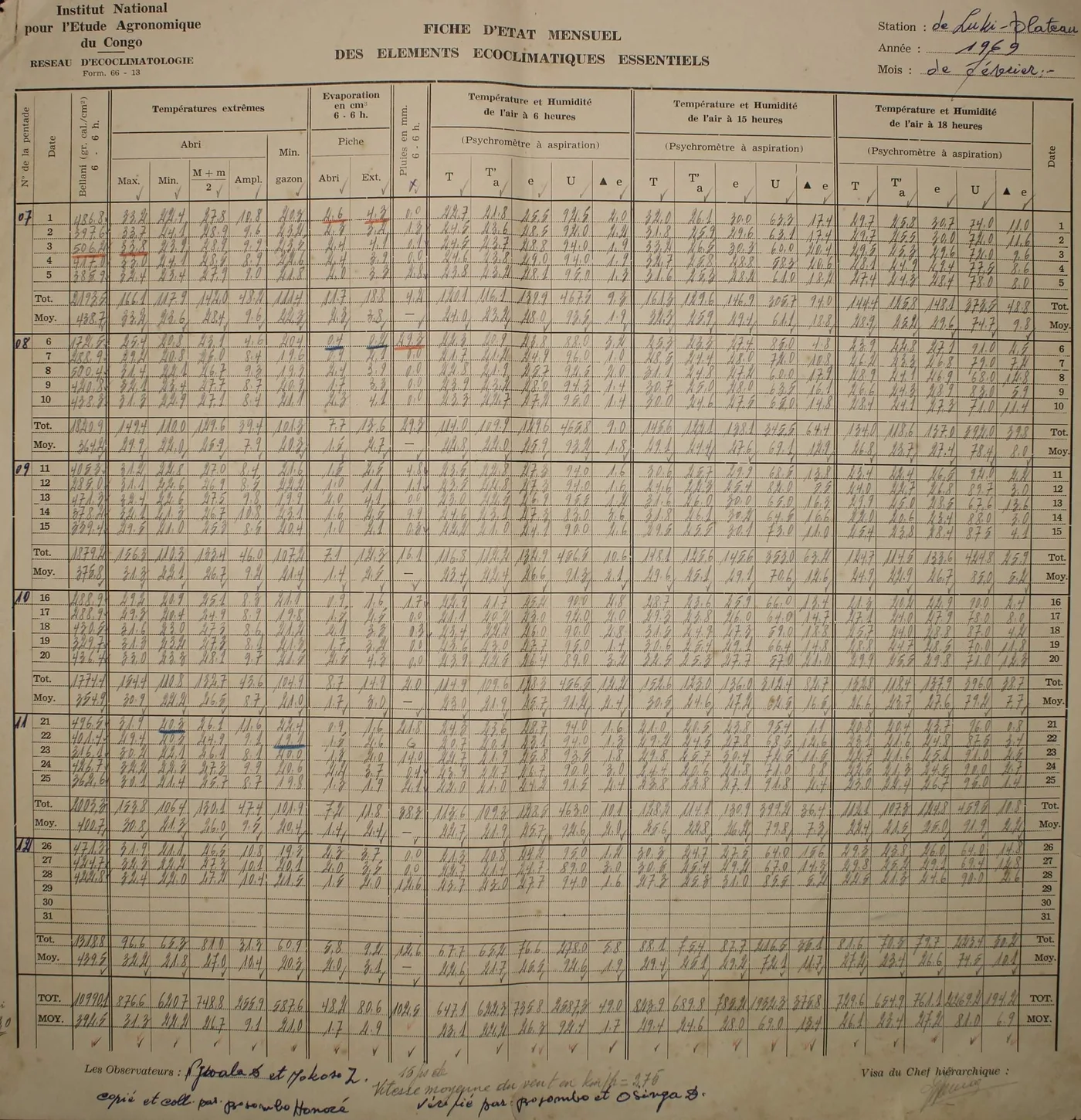
Inside the Section de Climatologie at INERA, paper weather sheets sat on open shelves exposed to humidity and insects. A fire had burned an adjacent wing of the facility just months before the team arrived. “Seeing that really drives home how fragile paper archives are – and how urgent it is to save this data before it disappears,” Muheki said. While weather archives in Brussels use climate-controlled metal boxes, the Yangambi facility lacked electrical power entirely [3].
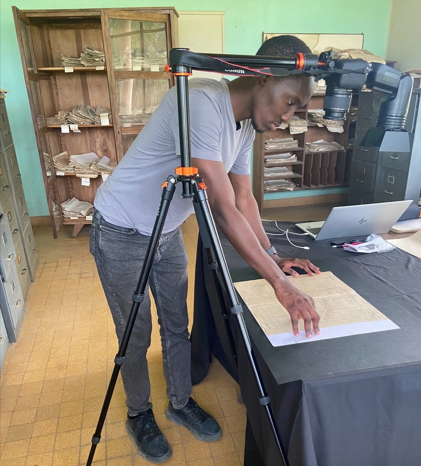
The expedition operated under battery power and spent two weeks cataloguing station names, geographic coordinates, and elevations before beginning photography. Over two months, the team photographed 9,885 handwritten monthly sheets from 37 weather stations stationed around the Democratic Republic of the Congo. Most logs spanned the period from the 1960s to the mid-1990s, when national conflicts interrupted systematic collection [5]. The visual records saved decades of irreplaceable field science from decay [4].
Automating Weather Transcription With MeteoSaver
Manual transcription of nearly ten thousand photographs containing cursive handwriting would have required decades of labor, so Muheki developed an automated pipeline named MeteoSaver with Ghent University researchers at the Ghent Centre for Digital Humanities. The open-source tool uses adaptive threshold binarization to clean page images, computer vision algorithms to detect tabular cell grids, and trained Tesseract optical character recognition models before exporting files in the Station Exchange Format prescribed by the Copernicus Data Rescue Service [5]. In a description released as a preprint on EGUsphere that has not yet undergone formal peer review, the authors detailed how this workflow can process historical weather data within tropical institutions [2].
Atmospheric physics provides the foundation for validating transcribed values inside the software pipeline. Because original station observers calculated five-day and monthly totals on each sheet, MeteoSaver recomputes those sums from transcribed daily entries, confirming numbers when they match within a 0.2 degree Celsius tolerance. The pipeline also cross-checks dry-bulb temperature, wet-bulb temperature, relative humidity, and vapour pressure deficit taken at 06:00, 15:00, and 18:00 local time against standard psychrometric equations from the Smithsonian meteorological tables [5].
Through five iterative runs that fed validated entries back into the training process, confirmed values increased from about 321,000 to more than 1,019,000, marking a 215 percent rise. The study, coordinated through the VUB Water and Climate Department, tested the pipeline against manual transcriptions from five stations and reached concordance levels from 81.2 to 92.3 percent, recording an average difference of 0.35 degrees Celsius that falls within historical thermometer margins. The technology publication TIME awarded MeteoSaver a special mention in its roundup of top inventions for 2025 [5].
Evidence of Congo Basin Warming Across Stations
Researchers combined the digitized INERA records with colonial logs recovered from the State Archives of Belgium under the COBECORE project, assembling a continuous observational baseline from 1908 to 2023. The finished database includes daily maximum, minimum, and average temperatures recorded with daily rainfall totals. Primary observations from isolated forest outposts mirror the fieldwork needed for fieldwork tracking gorilla populations and disease threats in Central Africa, where physical field logs remain necessary for baseline environmental monitoring [1].
Statistical trend analysis using the Theil-Sen estimator on 21 stations with sufficient continuous data revealed clear warming at 20 locations. Between 1961 and 1990, median daily maximum temperatures rose by 0.22 degrees Celsius per decade, while minimum temperatures climbed by 0.10 degrees and mean temperatures increased by 0.15 degrees. Over this thirty-year span, average temperatures in the Democratic Republic of the Congo rose by 0.5 degrees Celsius and daily maximums climbed by about 0.7 degrees Celsius [1].
Stations with records extending beyond the 1990s prove that regional heating did not stop at the close of the twentieth century. Warming continued steadily into the 2000s, confirming that Congo Basin warming represents a persistent long-term shift rather than a temporary decadal anomaly [5]. The data confirms that Central Africa is experiencing temperature increases comparable to trends observed in Europe and North America [4].


Why Did Heat Extremes Double in Central Africa?
The most pronounced change in the rescued records appears in the frequency and severity of extreme weather events. When researchers compiled data from the entire station network, the annual frequency of unusually hot days—defined as readings above the 95th percentile of daily maximums—rose nearly twofold between the 1960s and the 1980s. Annual days exceeding 33.3 degrees Celsius climbed from about three to five, while days with average temperatures above 26.9 degrees doubled from three to six [1].
As hot days multiplied in the basin, cool days steadily disappeared. Days falling below the 5th percentile dropped from around seven per year to five, and cold nights declined at a matching pace [1]. At long-running monitoring stations like Luki-Plateau, Mulungu-Mulohe, and Yangambi-Km.5, the annual count of hot days more than tripled between 1961 and 2000 [5]. This shift proves that Congo Basin warming has intensified local thermal stress far faster than mean temperature shifts suggest [1].
How does this rapid rise in extreme heat affect local communities? Millions of residents in the Congo Basin rely on rain-fed subsistence farming and lack electrical cooling or modern health infrastructure. A doubled annual tally of hot days diminishes agricultural labor capacity, threatens crop yields, and elevates heat-related illness [5]. The findings show that tropical populations face severe climate hazards today despite bearing minimal historical responsibility for global industrial emissions [4].
Evaluating Rainfall Trends and Reanalysis Models
Rainfall patterns presented a more complex picture because only three stations preserved more than thirty years of quality-controlled daily precipitation data. At Mulungu-Mulohe, a 63-millimeter downpour that had a return period of roughly two years during the early decades became an annual event by the 1980s. Daily rainfall of 83 millimeters at Yangambi-Km.5 similarly doubled in frequency, though the third station at Gimbi-Plateau showed little change. The researchers noted that these rainfall trends remain station-specific examples until broader precipitation archives can be recovered [1].
To evaluate existing digital climate models, the team compared their physical station data against the European Centre for Medium-Range Weather Forecasts (ECMWF) ERA5-Land gridded reanalysis. Although the computer model reproduced broad seasonal cycles, it exhibited an artificial temperature jump of 4.5 to 5 degrees Celsius in the early 1950s that appeared in none of the station archives. Without local observation stations to anchor calculations, reanalysis algorithms produced noticeable baseline errors in equatorial Africa [1].
Just as reconstructions of global carbon dioxide history across geological eras demonstrate the fragility of planetary climate systems, physical weather records remain indispensable for testing computer simulations [1]. Rescued ground measurements provide the calibration data necessary to correct model distortions and improve future forecasting. Without accurate historical baselines, regional climate projections remain guesswork [4].
Ground Studies of Congo Basin Warming Reveal Data Gaps
Central Africa has long represented a glaring void in global climate science [1]. The Intergovernmental Panel on Climate Change (IPCC) Sixth Assessment Report could not evaluate long-term trends in heat extremes or heavy precipitation in the Congo Basin because ground observations were absent from international repositories. “Our work further highlights the urgent need for more data rescue projects, especially in data-sparse regions, to close knowledge gaps on climate trends,” senior author Wim Thiery said [4]. Understanding Congo Basin warming allows scientists to evaluate climate dynamics in the second-largest river basin on Earth [5].
Sustained observation remains necessary for scientific equity across the Global South. While historical expeditions such as archaeological surveys in the Amazon rainforest have illuminated South American ecology, African climate history has often been neglected [5]. “Historical climate data for Central Africa have been extremely scarce until now, and this open-access database provides new observations that help establish the climate context of a region now severely affected by climate change,” the research team at VUB said [6]. Collaborative research involving institutions like BlueGreen Labs, the University of Reading, Royal Museum for Central Africa, Université de Kinshasa, and Maynooth University provides the foundation for equitable adaptation planning [5].
Much work remains to be done inside African climate archives. An estimated 300,000 temperature measurements and 200,000 rainfall entries from Yangambi have been digitized but still await full quality verification. Furthermore, the COBECORE initiative has catalogued records from 575 pre-1960 weather stations that could yield millions of additional data points. The open publication of the Yangambi dataset on Zenodo and Copernicus repositories establishes a practical template for rescuing paper records in the Global South before time runs out [5].
- ACADEMIC JOURNAL Muheki, D., Hufkens, K., Jacobsen, K., Verbeeck, H., Boeckx, P., Kankonde Ntumba, D., Kapalay Moulasa, O., Vercruysse, B., Birkholz, J. M., Verbruggen, C., Hawkins, E., Lampe, S., Yakusu, E. K., Imwangana, F. M., Mbifo, J., Likwela, T. B., Meunier, F., Dewitte, O., Thorne, P., & Thiery, W. (2026). From paper to proof: revealing Congo Basin warming through rescued climate archives. Earth System Dynamics, 17(5), 1455-1511. [Article Link]
- PREPRINT Muheki, D., Vercruysse, B., Chandrasekar, K. K. T., Verbruggen, C., Birkholz, J. M., Hufkens, K., Verbeeck, H., Boeckx, P., Lampe, S., Hawkins, E., Thorne, P., Ntumba, D. K., Moulasa, O. K., & Thiery, W. (2025). MeteoSaver v1.0: a machine-learning based software for the transcription of historical weather data. [Article Link]
- ONLINE NEWS Cockerill, J. (2026). Thousands of handwritten records recovered from archives reveal the true scale of warming in the Congo. ScienceAlert. [Article Link]
- ONLINE NEWS Struzik, E. (2026). Thousands of handwritten records reveal scale of warming in the Congo. Yale E360. [Article Link]
- ONLINE NEWS Callahan, S. (2026). Millions of rescued handwritten records reveal Congo Basin warming. Scienmag. [Article Link]
- PRESS RELEASE Belga English. (2026). Congolese and Belgian archives reveal warming in Congo Basin. BelgaShare.be. [Article Link]
APA 7: PerEXP Teamworks. (2026). Rescued Weather Records Confirm Congo Basin Warming Trend. PerEXP Teamworks.


