





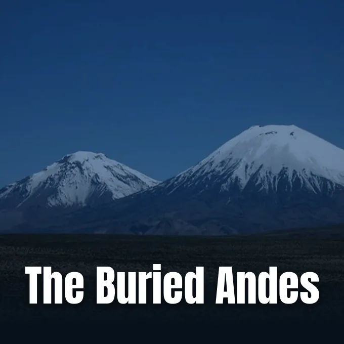
Nearly 22 million years ago, a devastating volcanic eruption in Northern Chile buried an entire prehistoric landscape under hundreds of meters of volcanic rock. The terrain vanished instantly. Could catastrophic destruction actually preserve delicate geological clues about how the Andes Mountains formed? By examining that ancient volcanic blanket, Byron Adams and University College London colleagues discovered that the mountain range was rising no faster than about an inch each century. [1, 2]
How a Devastating Volcanic Eruption Froze a Landscape
Mountain ranges appear permanent, yet tectonic forces push deep crustal rock upward while rivers carve steep valleys from above. Geologists face major challenges calculating how rapidly that push occurred tens of millions of years ago, because standard geological methods capture only isolated moments in Earth history. In Northern Chile, an immense blast roughly 21.9 million years ago sealed evidence beneath rock so thick and evenly tilted that only gentle terrain fit beneath it. Byron Adams at University College London led the study published in Science Advances, finding that the volcanic layer acted like a filter. As Byron Adams explained to Earth.com, the volcanic blanket preferentially preserves landscapes that were relatively subdued before the eruption. [1, 2, 3]
The physical reasoning is straightforward. A pyroclastic deposit naturally thins away from a volcanic vent, and its source must sit higher than the underlying terrain over which density currents travel. The buried preeruptive landscape could not have been steeper than the upper surface of the volcanic deposit. If rugged peaks had existed across Northern Chile, their summits would have projected above the volcanic sheet. Instead, the continuous layer completely engulfed the pre-existing topography. [1, 2]
Volcanic rock preserved the ancient topography. Because the blanket sealed the ground without exposing high peaks, researchers inferred maximum valley slopes. [1, 2]
Cardones Ignimbrite: The Giant Volcanic Blanket
The scale was immense. Geologists trace the outburst to the Lauca Caldera, an enormous depression in Northern Chile formed when the ground collapsed during an eruption. That collapse generated the Cardones ignimbrite (a volcanic rock formed from explosive ash deposits), the largest unit deposited during a regional burst of explosive volcanism following a devastating volcanic eruption. Expelled volcanic material exceeds 300 cubic miles (1,260 cubic kilometers). In places, the sheet measures roughly 3,300 feet (1 kilometer) thick. This formation directly underlies younger stratovolcanoes, including Parinacota Volcano and Pomerape Volcano. [1, 2]
The tilt was remarkably gentle. The upper surface of the Cardones Ignimbrite originally tilted westward at 1.5 degrees, representing an elevation rise of less than 8 feet across a football field. A slope of 1.5 degrees establishes a strict geometric ceiling for the underlying terrain. Understanding structural boundaries helps geologists interpret crustal movements, much like satellite studies revealing ancient folds shaping mountain ranges in northeastern Mexico. Across Northern Chile, the uniform volcanic sheet capped ancient river valleys and prevented subsequent erosion from modifying their slopes for millions of years. [1, 2]
Why Did Byron Adams Compare Chile to Pompeii?
Historic eruptions offer useful comparisons. When people ask what was the most destructive volcanic eruption in Earth history, they often think of Mount Vesuvius burying Roman settlements in ash. Byron Adams compared Chile to Pompeii, emphasizing the dramatic difference in physical scale. “This landscape was buried by a giant volcanic eruption – a little like Pompeii, but on a vastly larger scale,” Byron Adams said. “Instead of covering a town, hot mixtures of ash and gas swept across an entire landscape.” Superheated density currents smothered tens of kilometers of topography across Northern Chile. [1, 2]
The comparison illustrates how a devastating volcanic eruption alters geological preservation. While excavations at Pompeii exposed buildings frozen in time, the Cardones Ignimbrite preserved ancient river catchments across Northern Chile. Pyroclastic flows buried an entire regional ecosystem beneath thick volcanic debris. Investigating such massive events requires examining subsurface magmatic dynamics; PerEXP Teamworks recently highlighted similar subsurface investigations when examining magma chambers under the Hunga volcano after its 2022 explosion. Yet modern oceanic eruptions disrupt active sea basins, whereas the Chilean blast locked a continental plateau in place. [1, 2]

Scale matters in volcanic geology. The prehistoric Chilean event surpassed historic eruptions by hundreds of cubic kilometers of ejected material. [1, 2]

River Networks and the Shape of Ancient Mountains
Rivers shape mountain slopes. A landscape steepness reflects a continuous balance between tectonic uplift lifting rock upward and river networks cutting downward through bedrock. Fast-rising rock producing steep topography contrasts with slowly rising rock leaving gentle hills. To reconstruct the pre-eruption landscape without physically digging through solid ignimbrite, Byron Adams collaborated with Frances Cooper, Clementine Walsh, and Katharine Cashman from University College London, University of Bristol, and University of Oregon. The research team constructed a computer model that simulated river systems carving into a block of land measuring roughly 14 miles (22 kilometers) on each side. [1, 2]
The calculations were extensive. The researchers ran their numerical simulation 560 times across various combinations of rock uplift rates and bedrock erosion resistance. In each computational trial, simulated rivers carved terrain until channel networks reached steady-state equilibrium. Only the gentlest simulated terrains matched the actual 1.5-degree slope of Cardones Ignimbrite. Any faster uplift produced slopes far too steep to remain hidden beneath the blanket. Byron Adams explained that direct excavation was impossible: “We cannot dig down to see the buried landscape, but we can use the shape of the volcanic blanket to infer what is hidden beneath it.” [1, 2]
Did the Andes Rise Slowly or in Bursts?
By setting river resistance to values measured in bedrock channels elsewhere, the researchers calculated that Northern Chile was rising no faster than an inch (2.6 centimeters) per century before the eruption. That rate sounds remarkably gradual. In Taiwan, tectonic rock rises and erodes at approximately 16 to 24 inches (40 to 60 centimeters) every century. “The important point is that mountains do not simply rise like an elevator,” Byron Adams explained. “As rocks are pushed upward by tectonics, erosion is also removing material from the surface. If erosion keeps pace with rock uplift, the surface may not rise very much.” [1, 2]
Geologists have long debated whether the Andes Mountains rose slowly over 40 to 50 million years, or shot upward in a rapid late burst following a prolonged quiescent period. The new findings provide robust quantitative evidence supporting the slow and steady hypothesis. “Our findings support the slow but steady hypothesis,” Byron Adams stated. Independent mineral evidence corroborates this interpretation. Minerals in Northern Chile preserve geochemical cooling records reflecting their journey toward Earth surface, and previous cooling studies estimated a similarly gradual uplift over the last 50 million years. [1, 2]
Unanswered Questions Beneath the Volcanic Deposits
The rate is a ceiling. The calculated rate of an inch per century represents a maximum limit rather than an exact measurement. The numerical model simulates rivers alone and leaves out the gradual creep of hillslopes. When the team tested millions of more complex channel network configurations, every simulation produced even gentler terrain on average. The primary uncertainty involves ancient river erodibility (how easily water cut through regional rock millions of years ago). A softer environment could remain gentle even while rising slightly faster. [1, 2]
Similar volcanic formations exist across Alaska, Indonesia, and Argentina. Co-author Frances Cooper noted that this modeling framework could unlock buried topography worldwide: “The same approach could be applied to volcanic deposits elsewhere in the world, helping us reconstruct landscapes buried for millions of years.” Yet fundamental questions remain regarding how river systems recover after a devastating volcanic eruption resets the land. Byron Adams noted that massive deposits sever river networks and reshape mountain evolution over vast timescales. Remarkably, 22 million years after the blast, rivers in Northern Chile have still not finished cutting down through the Cardones deposit. [1, 2, 4]
Questions remain open. Scientific validation distinguishes peer-reviewed geology from preliminary research. The Andean uplift analysis completed formal review in Science Advances, whereas platforms like bioRxiv host unreviewed preprints on biological topics such as coral bleaching that have not undergone peer review [1, 5]. For Northern Chile, the volcanic blanket continues to anchor empirical models of mountain growth. [1, 2]
- ACADEMIC JOURNAL Adams, B. A., Cooper, F. J., Walsh, C., & Cashman, K. V. (2026). Landscapes buried beneath large-volume ignimbrites reveal preeruptive uplift rates. Science Advances, 12(37). [Article Link]
- ONLINE NEWS Arrais, L., & Ralls, E. (2026, September 12). Volcanic blanket preserved an ancient Andes landscape for 22 million years. Earth.com. [Article Link]
- ONLINE NEWS Discover Magazine. (2026). Devastating volcanic eruption engulfed part of Chile 21.9 million years ago, burying evidence of Andes uplift. Discover Magazine. [Article Link]
- WEBSITE Cooper, F. J. (2026). Parinacota and Pomerape volcanoes with Cardones ignimbrite [Photograph]. Earth.com. [Article Link]
- PREPRINT Contributions of human-caused climate change and individual emitters to global coral bleaching. (2026). bioRxiv [Preprint – not peer reviewed]. [Article Link]
APA 7: PerEXP Teamworks. (2026, September 13). A devastating volcanic eruption preserved clues to Andes uplift. https://perexpteamworks.com/en/devastating-volcanic-eruption-engulfed-part-of-chi/


